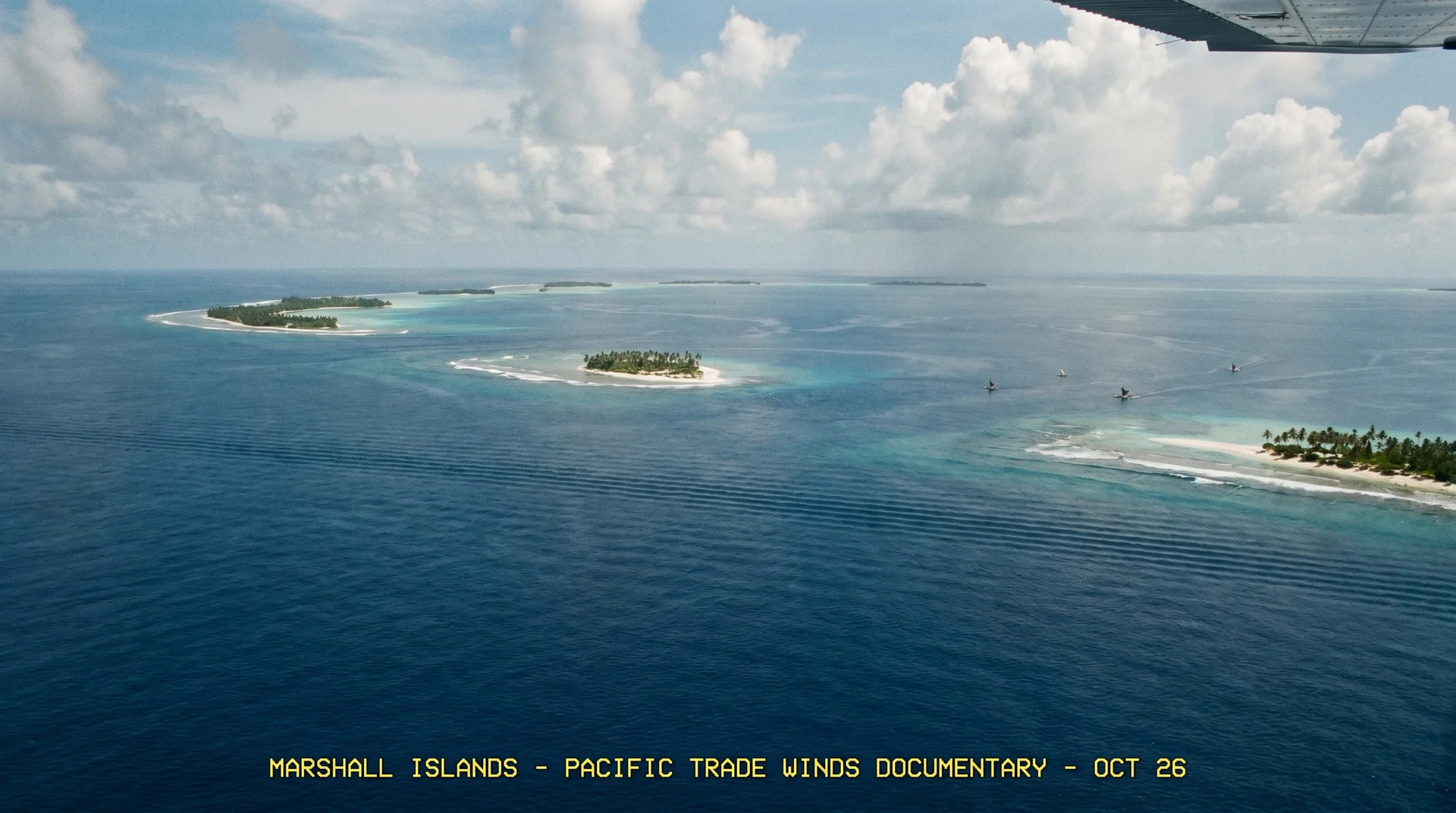
The Marshall Islands sit in the central Pacific roughly midway between Hawaii and Papua New Guinea, and almost every standard piece of travel advice gets the timing completely wrong. Popular sources suggest visiting in the dry season for better diving. The reality is the opposite: the calmer wet-season months are the only window when liveaboard expeditions to Bikini Atoll can actually operate. If you visit in the dry season expecting world-class wreck diving, you will find the boats docked and the expedition season firmly shut.
This guide breaks down the two entirely different travel calendars the Marshall Islands runs on, and how to decide which one applies to your trip.
The Two Seasons That Define Every Marshall Islands Trip
The Marshall Islands experience a classic maritime tropical climate with near-constant temperatures year-round. Daily averages sit between 27°C and 34°C (80°F to 93°F) in Majuro across every month. What changes dramatically is wind, rainfall, and, critically for divers, ocean surface conditions.
January through April is the dry season. Northeast trade winds keep humidity low and skies clear. Conditions on land are genuinely pleasant, with less rain and fewer mosquitoes than the rest of the year. But those same trade winds generate significant ocean swells that make Bikini Atoll completely inaccessible to dive vessels.
May through October is the wet and humid season. Rainfall is higher, tropical squalls roll through frequently, and the air is heavier. On the open ocean, however, the trade winds die down, and the surface flattens to a mirror calm. This is the only period when liveaboard operations can safely cross to Bikini Atoll and anchor over the historic wreck sites.
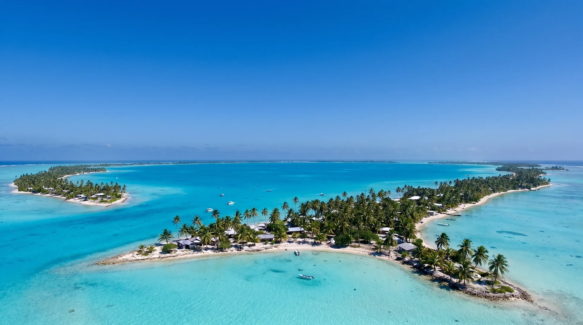
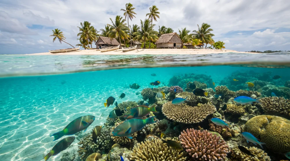
The country is divided into two parallel chains: the Ratak (Sunrise) chain to the east and the Ralik (Sunset) chain to the west. Bikini Atoll sits in the Ralik chain, as exposed to the Pacific as anywhere gets.
Marshall Islands Weather by Month
The table below maps the full calendar year across the key variables that actually affect travel planning:
| Month | Weather Profile | Sea Conditions | Bikini Atoll Status | Avg. Rainfall (Majuro) |
|---|---|---|---|---|
| January | Dry and breezy | Strong NE trade winds, rough seas | Closed | ~209 mm (8.2 in) |
| February | Driest month | High winds, significant swells | Closed | ~194 mm (7.6 in) |
| March | Dry and windy | Moderate to strong trade winds | Closed / Transition | ~220 mm (8.6 in) |
| April | Transition to wet | Winds begin to soften | Expeditions may begin | ~282 mm (11.1 in) |
| May | Wet season begins | Calm seas, light breezes | Peak liveaboard season | ~272 mm (10.7 in) |
| June | Hot and humid | Flat, mirror-like surface | Peak liveaboard season | ~282 mm (11.1 in) |
| July | Rainy, typhoon risk | Calm seas, convective storms | Peak liveaboard season | ~278 mm (11.0 in) |
| August | Heavy tropical showers | Minimal wind, excellent visibility | Peak liveaboard season | ~284 mm (11.2 in) |
| September | High humidity | Excellent underwater clarity | Peak liveaboard season | ~320 mm (12.6 in) |
| October | Wettest month | Unpredictable squalls, low wind | Liveaboard season ends | ~350 mm (13.8 in) |
| November | Transition to dry | Trade winds return | Closed / Transition | ~341 mm (13.4 in) |
| December | Breezy and cooling | Strong NE trade winds | Closed | ~302 mm (11.9 in) |
January to April: Dry Season, Best for Land Exploration
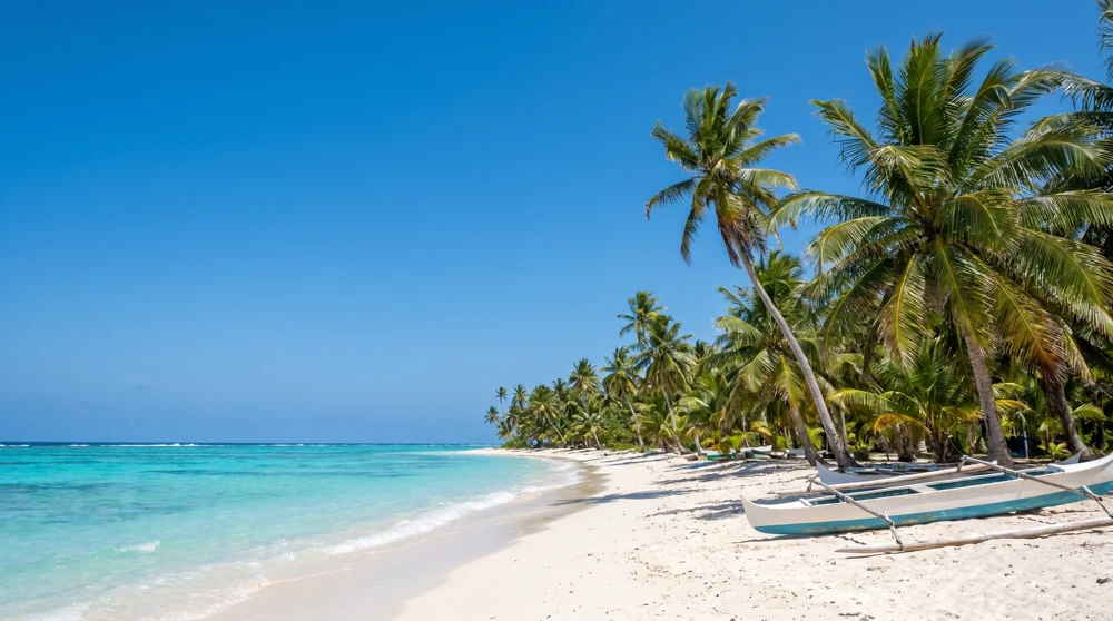
The dry season is the most comfortable time to visit Majuro and the inhabited atolls. Steady northeast trade winds act as a natural air conditioner, keeping the oppressive equatorial humidity manageable. Skies are clearer, mosquito populations are lower, and outdoor sightseeing (walking tours of Majuro, visiting the Alele Museum, photographing traditional handicraft markets, and exploring Laura Beach on the western tip of the atoll) is considerably more pleasant.
One geography note worth knowing: rainfall varies dramatically between the northern and southern atolls. The northern atolls receive roughly 1,800 mm (70 inches) of rain annually. The southern atolls, including Majuro, average up to 4,300 mm (170 inches) per year. Even in the dry season, brief heavy showers pass through the south, though they typically clear within minutes.
For travel between Majuro and the outer islands, be aware that local boat services can be hazardous from December to April due to strong currents and storm surges. Domestic air services exist but run on inconsistent schedules. Build flexibility into any outer-island itinerary regardless of season.
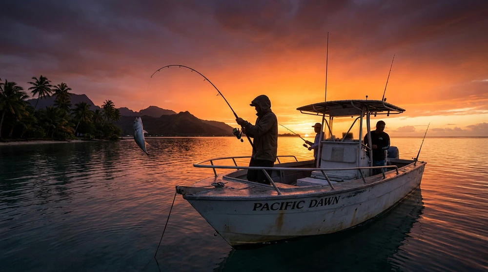
May to October: Wet Season, the Only Window for Bikini Atoll
By May, the protective trade winds fade and humidity rises sharply. The wet season runs through October, peaking in rainfall during those final two months. Tropical squalls are common, and the Marshall Islands lie within the active Pacific typhoon belt, with the primary storm season spanning July to November.
Despite this, May to October is the only viable time for the activity most serious travelers come for: technical diving on the historic nuclear ghost fleet at Bikini Atoll.
When the trade winds die down, the open-ocean surface becomes genuinely calm. This calm is what makes liveaboard operations possible. Without it, the swells are simply too large and unpredictable for vessels to anchor over fragile historic wrecks and safely manage technical dive entries and exits across open water.
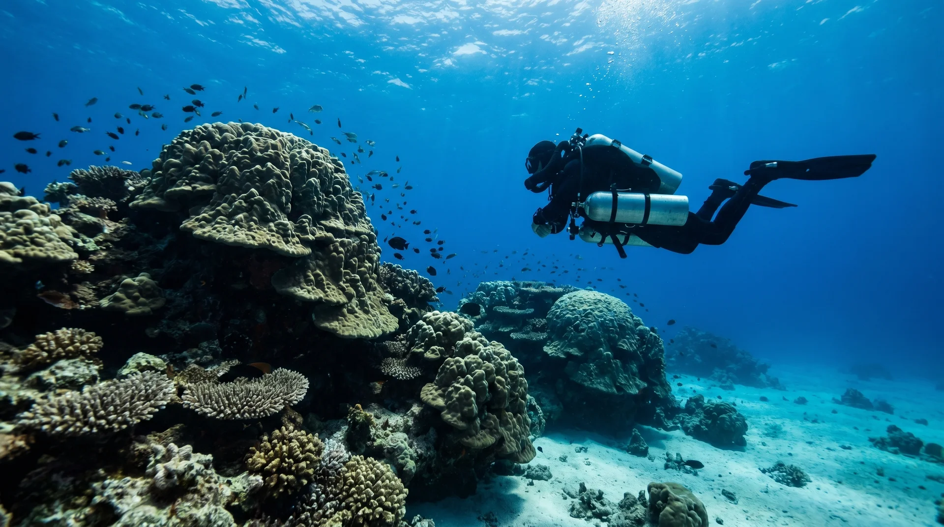
Bikini Atoll Diving: The Historic Nuclear Fleet
Between 1946 and 1958, the United States conducted 23 nuclear tests at Bikini Atoll under Operation Crossroads. The detonations sank a fleet of decommissioned warships deliberately placed in the lagoon as test targets. The radioactive danger in the water has long since dissipated, leaving behind an accidental marine sanctuary of extraordinary depth and historical weight.
The headline wreck is the USS Saratoga, a 270-metre (888-foot) aircraft carrier with a flight deck and aircraft hangars still largely intact, one of the most impressive single dive sites on earth. The HIJMS Nagato, the Japanese battleship that served as Admiral Yamamoto's flagship and coordinated the Pearl Harbor attack, rests nearby. Other targets include submarines, destroyers, and support vessels.
Most key wreck sites sit at depths between 40 and 55 metres (130 to 180 feet), far beyond recreational dive limits.
Technical Certification Requirements
Diving Bikini Atoll is not for recreational divers. Operators require verified technical certifications at minimum PADI Tec 45 or TDI Advanced Nitrox and Decompression Procedures level, with documented wreck diving experience. Rebreather (CCR) certifications are strongly encouraged for extended bottom times at depth. Gas requirements (Trimix mixes, oxygen percentages) must be submitted to operators at least six months before departure to guarantee preferred mixes. Submit later and you may not get your required gases.
Water Conditions During Dive Season
Water temperature ranges from 27°C to 30°C (81°F to 86°F) throughout the dive season. A 3mm wetsuit or shorty is typically sufficient for most dives, though divers doing repeated long decompression stops at depth often add thermal protection.
Visibility regularly exceeds 30 metres (100 feet). The Marshall Islands are remote coral formations with no river systems and no agricultural runoff, virtually nothing to cloud the water. The marine life on and around the wrecks has recovered to a pristine state after decades of no commercial fishing. Grey reef sharks, silvertip sharks, and manta rays patrol the deep drop-offs. Massive brain and staghorn coral formations cover the wreck superstructures.
Tidal currents through the passes between the open ocean and the inner lagoon can be fierce and unpredictable, sweeping directly across open wreck decks. Excellent buoyancy control, physical fitness, and strict gas management are non-negotiable.
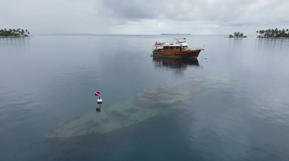
The Liveaboard Reality
As of 2026, the Pacific Master operates as the primary liveaboard for Bikini expeditions, with 12 air-conditioned cabins accommodating up to 16 divers maximum and a full technical diving setup including a decompression bar. 10-night trips start from US$5,850 per person, with 13-night itineraries reaching US$7,605, before international flights and technical gas surcharges.
Book at least 12 to 18 months in advance. Historically, 2 years ahead was the standard recommendation given limited vessel capacity. Demand significantly exceeds supply. If you are targeting a specific departure season, start the booking process well before the expedition year opens.
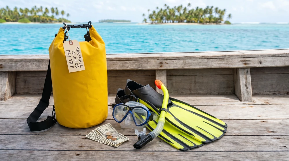
For divers planning a broader Pacific micro-nation trip, both diving and snorkeling in Nauru and the reef systems around Tuvalu offer completely different but equally remote underwater experiences.
Getting to the Marshall Islands
All international arrivals land at Amata Kabua International Airport (MAJ) in Majuro. The only commercial lifeline is United Airlines' famous Island Hopper service (Flight UA154/155), running three times weekly between Honolulu and Guam with stops at Majuro, Kwajalein, Kosrae, and Pohnpei. Ground time in Majuro is approximately 45 minutes per stop. United is upgrading the route to Boeing 737 MAX 8 aircraft through 2026.
Roundtrip economy fares from Honolulu to Majuro run approximately US$1,481 at current rates. There is no budget carrier alternative, no competing route, and no workaround. A delayed leg on the Island Hopper can cascade through an entire multi-island itinerary. Build at minimum one buffer day in either direction.
For liveaboard expeditions to Bikini Atoll, most operators stage from Majuro. Some itineraries include a charter flight to a closer atoll as the departure point, so confirm logistics with your operator well before travel.
For a sense of how other remote Pacific nations handle their airport and flight situation, the experience at how to get to Nauru and flying to Tuvalu are useful comparisons, as each has its own single-carrier dependency.
Entry Requirements and Practical Planning
Citizens of the United States, EU member states, and most Pacific nations receive a 30-day visa on arrival at Majuro, extendable to 90 days at the Immigration Office. Your passport must be valid for at least six months beyond your intended departure date, with at least two blank pages.
Measles vaccination proof is required for all travelers between six months and 62 years of age. Carry official documentation from a doctor if you have a contraindication. Border officials check this at boarding, not just on arrival.
Tap water in Majuro is not potable. Do not drink it, and do not use it to brush your teeth. Bottled water is widely available.
For dress standards: the Marshall Islands is conservative. Women should cover knees and shoulders in public. This applies to visitors as firmly as to residents.
For budget planning, the extreme isolation means almost everything is imported. Food, fuel, and specialized dive gases are expensive relative to nearby Pacific destinations. Even land-based visits to Majuro carry a higher daily spend than comparable Pacific trips to more accessible islands.
Travel insurance is not optional for this destination. Any policy covering the Marshall Islands must explicitly include medical evacuation coverage, as the nearest serious medical facility is in Hawaii or Guam. For technical divers, your policy must additionally cover decompression accidents and deep technical diving emergencies.
For country collectors, both Tuvalu for country collectors and Nauru for country collectors cover the specific planning considerations that apply to visiting the Pacific's hardest-to-reach nations, and the same logistical discipline applies here.
How the Marshall Islands Compares to Its Pacific Neighbors
If you are weighing the Marshall Islands against other remote Pacific micro-nations, the key differentiator is technical diving. No other destination in the Pacific offers anything close to the Bikini Atoll wreck experience.
For travelers not on a technical diving mission, Nauru vs Tuvalu explores how those two destinations compare on accessibility, cost, and what you actually find when you get there. Both sit in the same "highly remote, single airline" category as Majuro but offer different ground experiences.
Similarly, the best time to visit Tuvalu and best time to visit Nauru follow weather-based logic similar to the Marshall Islands dry season pattern, though neither has the diving season inversion that defines Marshall Islands planning.
The Marshall Islands rewards the traveler who arrives with a clear purpose. For the technical diver, there is no substitute. For the cultural explorer, the dry season window from January through April delivers the most comfortable conditions the Pacific can offer at this latitude.