Arriving in Porto Novo without a clear transport strategy usually results in paying exorbitant private taxi fares before even reaching the trailhead. Navigating the steep volcanic terrain of this island requires mastering the local transport system just as much as physical stamina.
Here is a quick look at the essential logistics before you arrive:
- Ferry Connection: 60 minutes from Mindelo (São Vicente) to Porto Novo, ~1,100 CVE
- Transport: Shared aluguer colectivo (100-500 CVE) vs. private frete (up to 7,000 CVE)
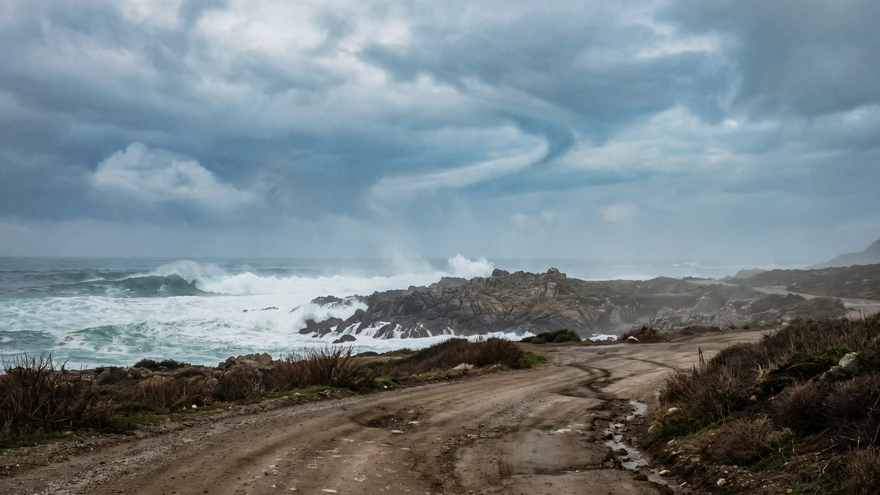
- Terrain: Highly uneven cobblestone, steep descents, exposed coastal cliff edges
- Gear: High-traction trail shoes, windbreaker, min 2 liters water per person
- Main Hubs: Paul Valley, Ribeira Grande, and Ponta do Sol
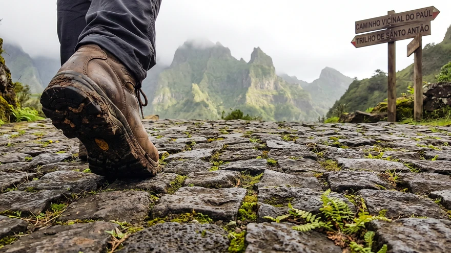
How to Get to Santo Antao
The island operates entirely without a functional airport, making the sea route your only entry point. Ferries depart daily from Mindelo on the neighboring island of São Vicente, taking roughly an hour to cross the channel. The Cabo Verde island hopping ferry network makes this connection reliable and affordable for most schedules.
The terminal at Porto Novo acts as the central nervous system for the island's logistics.
Upon stepping off the morning ferry, a chaotic but highly organized fleet of minibuses and pickup trucks will be waiting. Securing your onward transport immediately is crucial to avoid losing precious daylight hours on the trails.
Navigating the Island: Aluguers vs. Private Taxis
Understanding the difference between an aluguer colectivo and a frete saves serious budget and frustration. Minibuses operate as shared transport (colectivos) along fixed routes, filling up with locals and cargo before departing.
Drivers frequently approach tourists offering an immediate departure, which transitions the ride into a frete (private taxi).
Always explicitly state you want the colectivo price and are willing to wait for the vehicle to fill. Fares along the paved coastal road from Porto Novo to Ribeira Grande are fast and cheap, usually costing around a few hundred escudos.
The old cobblestone road (Estrada de Corda) slicing straight through the mountainous interior commands higher fares due to the punishing terrain. Taking this central route at least once is mandatory for the sheer visual scale of the volcanic ridges. For a full breakdown of what to budget across the island, Cabo Verde travel costs covers transport, accommodation, and daily expenses in detail.
Top Santo Antao Hiking Trails
Cova Crater to Paul Valley (The Green Descent)
- Distance: ~10 km
- Duration: 5-6 hours
- Difficulty: Medium
- Start: Cova Crater Rim
The trail begins at the lip of a dormant volcanic crater, often completely swallowed by morning fog. A steep, zig-zagging cobblestone path drops sharply down the northern face of the mountain.
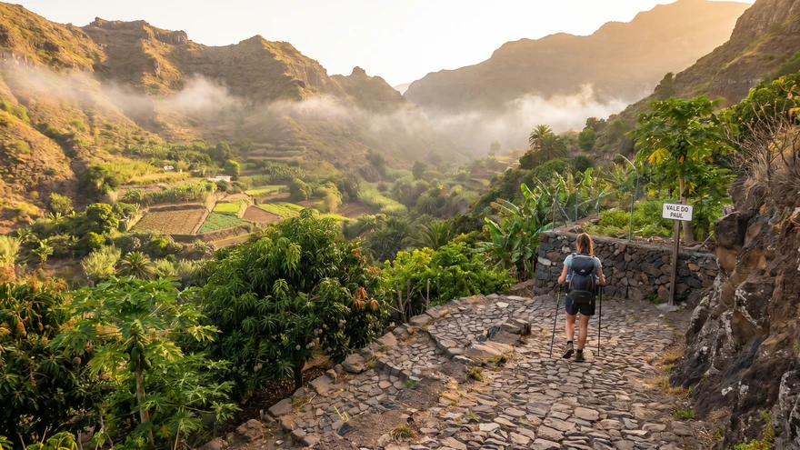
Thick pine forests at the top quickly transition into terraced agricultural fields. Mango trees, papaya groves, and sugarcane plantations dominate the lower valley.
Walking downhill for hours puts immense pressure on the joints. Using a sturdy pair of hiking poles significantly reduces the impact on the descent into the town of Paul. Local taverns near the valley floor serve heavy plates of Catchupa (the national corn and bean stew) to refuel after the long drop.
Ponta do Sol to Cruzinha (The Coastal Edge)
- Distance: ~14.5 km
- Duration: 6-7 hours
- Difficulty: High
- Start: Ponta do Sol
A sheer drop into the Atlantic ocean on one side and towering black basalt cliffs on the other. This donkey trail connects a series of remote, car-less hamlets clinging to the edge of the island.
The village of Fontainhas, appearing shortly after the start, sits dramatically on a razor-thin ridge surrounded by deep ravines.
Starting this hike by 7:00 AM is a strict necessity. The afternoon sun reflects harshly off the dark volcanic rock, and shade is practically nonexistent for the last several kilometers. Securing transport back from the endpoint at Cruzinha to Ribeira Grande requires timing your finish before the local drivers head home for the evening.
Ribeira Grande to Xôxô Valley
- Distance: ~8 km (variable based on starting point)
- Duration: 3-4 hours
- Difficulty: Easy to Medium
- Start: Ribeira Grande or Água das Caldeiras
Unlike the wide expanses of Paul, the Xôxô valley feels narrow, vertical, and intensely rugged. Giant monolithic rock pillars shoot straight up from the valley floor, creating a natural amphitheater of stone.
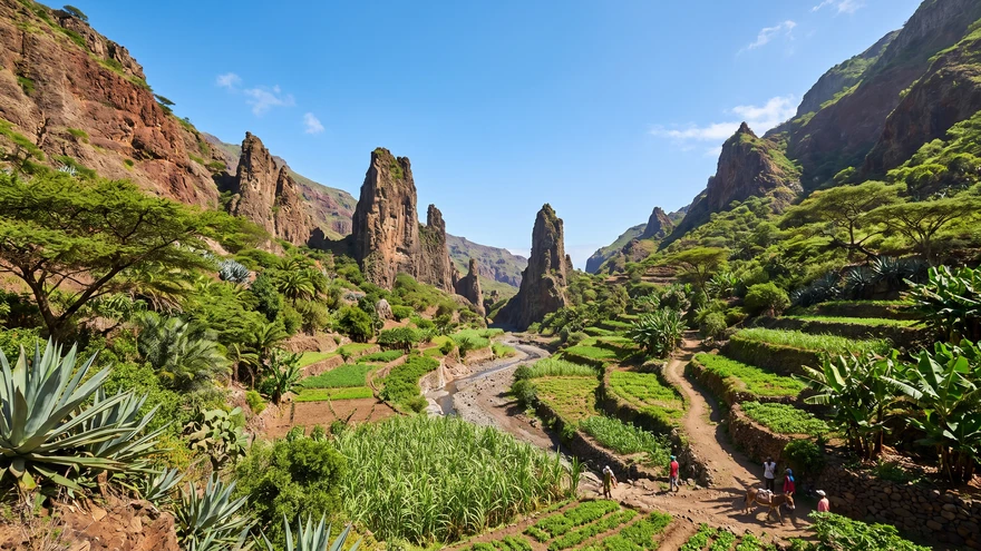
The trails here weave through small settlements like Rabo Curto and Lombo de Pico.
Many sections utilize the paved roads, requiring vigilance for passing agricultural vehicles. The micro-climate deep in Xôxô traps moisture, keeping the terraced farms vibrantly green year-round.
Village-to-Village Route Planning
Stringing multiple hikes together requires treating Ribeira Grande as your primary transit hub. Most aluguers pass through this central northern town, making it the easiest place to catch connections to the Paul Valley, Xôxô, or Ponta do Sol.
Hiking linearly from village to village often means carrying your main backpack. Utilizing the coastal transport network allows you to leave heavy luggage at a basecamp and tackle the steep ascents with just a daypack.
Where to Base Yourself: Ribeira Grande or Paul?
Choosing a base camp alters the entire rhythm of the trip. Ribeira Grande offers unparalleled logistical efficiency, acting as the nexus of the island's road network. For options across the island, where to stay in Cabo Verde covers guesthouses and local accommodation by area.
Paul Valley provides immediate access to nature. Waking up surrounded by sugarcane fields and mist-covered peaks comes at the cost of being slightly further from the transport hubs.
Ponta do Sol strikes a balance, offering oceanfront dining, a small expat community, and direct access to the famous coastal trail, though it requires an extra transport leg to reach the inland craters.
Trail Safety and Essential Gear
The cobblestone paths (caminhos vicinais) built into the mountainsides are historic engineering marvels, but they are unforgiving on modern footwear. Soft-soled sneakers wear down rapidly on the jagged rocks.
Rockfalls occur frequently during or immediately after heavy rain.
Carrying physical cash in small denominations is vital for buying water or local sugarcane rum (Grogue) from remote village vendors, as digital payment systems do not exist on the trails. Always download offline maps before leaving your accommodation, as cellular signals drop completely within the deep ravines.