Showing up in Nauru with an unregistered drone and a casual plan to hike the interior is the fastest way to get your gear confiscated and end up lost in a jagged limestone labyrinth. The Topside is not hostile to visitors, but it is deeply indifferent to unprepared ones. Navigating the heavily mined interior requires a grasp of local land ownership customs, an off-road capable vehicle, and a clear understanding of which zones are strictly off-limits.
- Getting around: renting a car or a sturdy 4x4 is mandatory; there is zero public transportation on the plateau
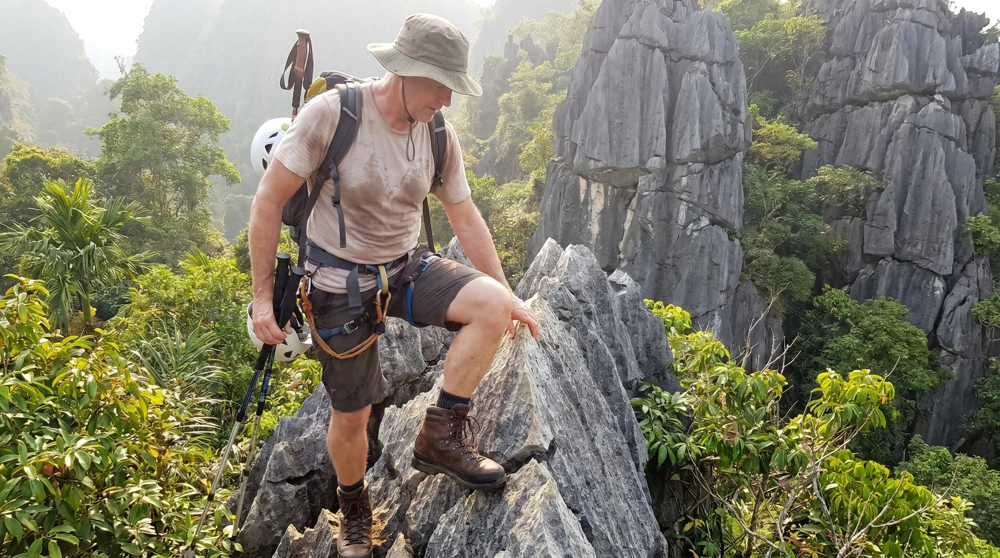
- Physical difficulty: moderate to hard, terrain consists of sharp coral pinnacles and unpaved, dusty tracks
- Restricted zones: Australian offshore detention facilities are strictly off-limits, photography near fences is prohibited
- Climate: equatorial heat with zero shade across mined areas
- Drone policy: extremely strict, prior authorization and customs paperwork required before arrival
- Local guide cost: approximately A$40 and strongly recommended for WWII sites
What Exactly Is the Topside?
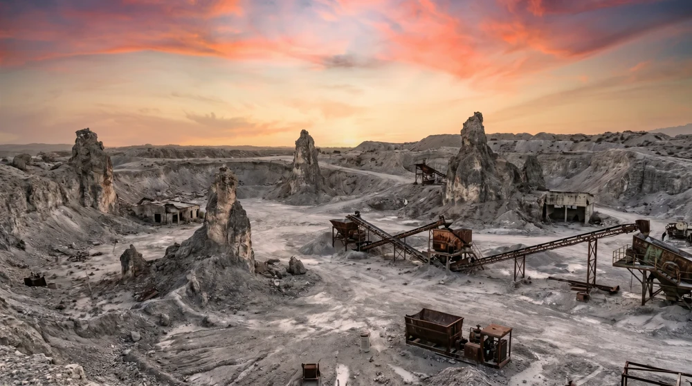
Topside is the local term for the central plateau, a devastated zone covering roughly 80 percent of the entire island. This is the ground zero of a century-long phosphate extraction process. In 1899, geologist Albert Ellis identified that the raised interior was almost entirely composed of high-purity phosphate, the calcified remains of millions of years of seabird guano accumulation. The Nauru phosphate history article traces what happened from that discovery through independence. Mining began under German colonial administration in 1905 and continued through British, Japanese, and finally Nauruan management until the deposits were effectively exhausted.
What remains is a physical manifestation of a collapsed economy. The landscape is a rolling sea of jagged coral spires, some reaching up to 15 meters high, left standing when the surrounding phosphate matrix was scooped away. There is no topsoil, no organic matter, and no natural canopy. Between the towering limestone pillars, only a few introduced weeds survive the intense equatorial sun. Researchers have concluded that meaningful soil regeneration is scientifically impossible here because the organic substrate took millions of years to accumulate and has been physically removed and exported. The Topside is a permanent monument to what happens when an entire nation's geology is treated as a finite commodity.
The Nauruan government's Higher Ground Initiative aims to eventually resettle the coastal population inland as sea levels rise, but any agricultural rehabilitation faces an essentially insurmountable soil deficit.
How to Navigate the Nauru Interior
Forget about public buses or marked hiking trails. The coastal ring road is paved, but the moment you turn inland toward the Topside, the infrastructure vanishes into a network of unmapped dirt tracks originally cut by the Nauru Phosphate Corporation for mining access. These gravel roads are technically public but have no signage and no maintained surfaces.
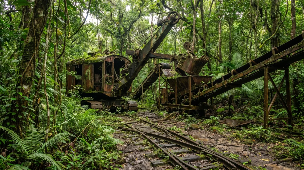
Renting a car from your accommodation provider is the only viable way to cover the distances and handle the steep inclines. Daily rates for 4WD vehicles run approximately A$80 (around US$50). A vehicle with high clearance makes the bumpy, dust-choked tracks manageable; a standard sedan risks ground damage on the steeper inclines. Keep an eye on the roadside as you drive: you will spot remnants of the old narrow-gauge railway once used to transport phosphate from the interior down to the cantilever loading points on the coast.
The interior tracks are completely unlit. Navigation after dark is dangerous and practically impossible. Plan your Topside exploration for early morning, both to use the cooler hours and to avoid the punishing midday heat that turns the reflective white limestone into an open oven. The best time to visit Nauru guide covers which months give you the most comfortable conditions island-wide.
Hiring a local guide for approximately A$40 is strongly recommended, not just for navigation but for land permission etiquette. All land on Nauru is privately owned by individuals or family groups. Approaching a site without acknowledging the landowner is a cultural misstep; most visitors report they have never been refused access when asking politely.
Command Ridge and the Japanese WWII Guns
Command Ridge at 65 meters is Nauru's highest point and the most concentrated WWII site on the island. A massive rusting Japanese anti-aircraft gun sits on its original mount at the summit, with communication bunkers scattered through the surrounding rocks and a crashed B-25 Mitchell bomber partially hidden in the undergrowth.
The entry gate is not marked from the road, and the path up is easy to miss without a guide. Allow 10-15 minutes at the top; bring water and closed-toe shoes.
For the full site map including the hidden bunkers, the B-25 crash site location, and the complete WWII history of the occupation, see Command Ridge Nauru.
The Hidden Japanese Prison
Locating the old Japanese prison requires off-trail scrambling through secondary growth. There are no signs pointing to it, and reaching the structure involves climbing over fallen trunks and dense underbrush. The Yaren Museum is the best starting point for orientation; the curator can point you toward sites and provide historical context.
The prison is a stark, derelict reminder of the forced labor system the Japanese military established during the occupation. Iron bars rusted thick, concrete walls crumbling. You can walk freely around the ruins, but watch every step on the unstable debris. This is one of the sites where a local guide pays for itself: the route in is easy to lose, and there is no mobile signal to navigate by.
Buada Lagoon
Buada Lagoon is the island's only natural freshwater body and a striking visual contrast to the Topside wasteland. Swimming is not recommended due to water quality, but the dense palms and calm atmosphere make it worth a short detour from the main plateau route. The lagoon sits within a residential neighborhood, so keep your voice down and respect the community as you walk the perimeter.
For the full visiting context, birdwatching spots, and the Moqua Well nearby, see Buada Lagoon Nauru.
The Abandoned Phosphate Cantilevers
While technically located on the western shoreline in the Aiwo district rather than on the Topside itself, the massive loading cantilevers are the direct endpoint of everything dug out of the interior. These towering, rusting structures stretch out over the reef.
They are colossal oxidizing skeletons of the phosphate boom. Stand near the harbor walls at sunset to see their dark silhouettes against the Pacific Ocean. They serve as a powerful visual counterpoint to the Topside: if the interior shows where the phosphate came from, the cantilevers show exactly how it left.
Essential Safety and Logistics Rules
Wandering into the wrong area in Nauru carries immediate consequences. The Australian offshore immigration processing facilities are located deep within the pinnacle fields. These are high-security zones surrounded by barbed wire and monitored perimeters.
Stay away from the detention centers completely. Do not approach the gates, and under no circumstances point a camera toward the fences or perimeter walls. This is not a guideline; it is enforced. The offshore detention article explains the legal framework and exactly what photography restrictions apply.
Respect the drone ban absolutely. Attempting to fly an unregistered drone near the interior will lead to immediate confiscation and potential legal consequences. Authorization must be arranged before you arrive on the island, not on the day.
Manage the climate aggressively. The Topside is a bowl of reflective white limestone with zero shade. Wear a wide-brimmed hat, apply high-SPF sunscreen, and carry at least three liters of water per person for a half-day visit. Heat exhaustion risk here is real, not theoretical.
Watch for active mining. A small fraction of residual phosphate extraction still occurs across the plateau. If you see heavy machinery operating near the dirt tracks, give it a wide berth and do not stop for photographs near active equipment.
Beware of wild dogs. Packs of stray dogs roam the interior tracks and the coastal roads. Carry a sturdy walking stick as a precaution and avoid walking alone on remote paths. The dogs are generally not aggressive toward vehicles but can act defensively toward pedestrians approaching their territory.
The Topside is one of the most genuinely alien landscapes accessible to travelers anywhere in the Pacific. The combination of industrial-scale environmental destruction, intact WWII hardware, and the eerie silence of a plateau that once generated some of the highest per-capita income in the world makes it unlike anything else. Come prepared, move slowly, and ask permission before you step off the track.