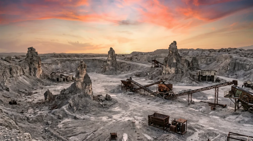
The most common mistake at Command Ridge is turning back at the Digicel broadcast towers. That cluster of modern antennas marks the peak, but the actual World War II sites begin precisely where the concrete infrastructure ends. The anti-aircraft guns, communication bunkers, and scattered aircraft wreckage are all hidden in the dense phosphate pinnacles just beyond the digital installations, and reaching them requires pushing through overgrowth that most visitors never bother with.
What Command Ridge Was During the Japanese Occupation
Japanese forces occupied Nauru from August 26, 1942, to September 13, 1945, a three-year period that left the island scarred and its population decimated - the human toll of that occupation is commemorated every year in Angam Day, Nauru's most significant national holiday. Command Ridge, sitting at 65 metres (213 feet) above sea level, was the obvious choice for a communications and anti-aircraft installation. Its elevation gave a commanding view of the western coastline and the approach corridors used by Allied aircraft.
The Japanese constructed their main communications bunker directly into the ridge's limestone formations, using the existing rock as natural cover. Anti-aircraft guns were positioned around the summit perimeter. The island's military value lay in its strategic position across Pacific air corridors, not in its phosphate, which the Japanese failed to extract in any meaningful quantity. Australian workers had sabotaged the phosphate facilities before evacuation, and Japanese engineers found recovery impractical.
By the time Australian forces accepted the Japanese surrender from Commander Hisayuki Soeda on September 13, 1945, approximately 1,200 Nauruans had been forcibly deported to the Truk Islands, more than 1,600 kilometres away. Fewer than 800 returned in 1946. The occupation's legacy drove Nauruan self-determination efforts and ultimately led to independence in 1968. The full context of what phosphate meant for Nauru's colonial history is covered in the Nauru phosphate history article.
The 127mm Anti-Aircraft Guns
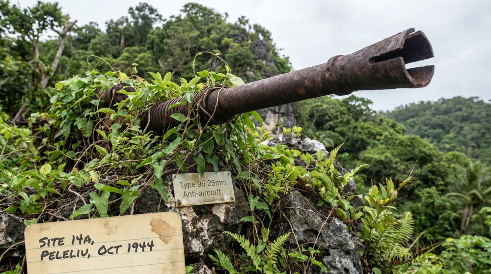
The most striking remnants on the ridge are the Type 29 127mm dual-purpose naval guns. These are not the small 12.7mm machine-gun calibre weapons that appear in some travel descriptions, but heavy-barrel, semi-automatic pieces originally powered by hydraulic motors. The massive barrels point skyward, their muzzles split and blown apart by Australian occupation forces at the end of the war. The demolition was deliberate and permanent.
The steel is heavy with rust after eight decades, and the surrounding circular stone enclosures are thick with vines. Look closely at the inner perimeter walls. Regularly spaced recesses that once held crates of fixed ammunition are still clearly visible under the moss, intact enough to show exactly how the gun crews organised their ready-supply positions.
Reaching the guns is not straightforward. At the top of the road that ends at the saltwater tanks, head left and step directly into the undergrowth past the digital phone installations. The historical perimeter starts exactly where the modern concrete ends. The path is essentially a zig-zag trench system that meanders south along the ridge. You follow low stone walls left or right, physically pushing heavy branches aside.
The Japanese Communication Bunkers and Tunnels
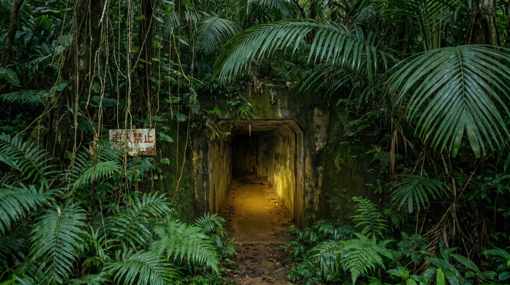
Beneath the highest sections of the ridge, a complex network of bunkers sits reinforced with concrete and natural overburden. The Japanese forces used the existing rock formations intelligently, allowing the tunnels to blend into the landscape so thoroughly that finding the entry points remains difficult even today. Mounds of earth and dense shrubs completely obscure the narrow doorways.
Inside, the atmosphere shifts immediately. The air is heavy, the corridors are pitch black, and the temperature drops several degrees. The command complex features multiple rooms interconnected at different levels, separated by deteriorating steel-rung ladders. Faint Japanese characters remain scrawled across some of the interior concrete walls, still legible enough to identify as original wartime markings rather than later additions.
Always bring a high-powered flashlight and test every rung before committing your weight. The structural decay is significant, and sudden drops or loose concrete sections appear without warning. Exploring the deep underground sections without a local guide is not recommended regardless of your experience level.
The B-25G Mitchell Crash Site
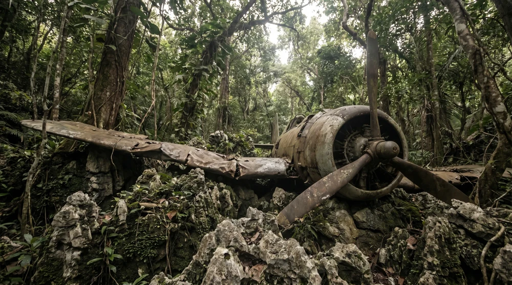
Just east of the main ridge, within the worked-out phosphate diggings, lie the scattered remains of a B-25G Mitchell bomber known locally as the "Coral Princess." This heavily armed American aircraft was shot down by intense anti-aircraft fire during a low-level attack run in June 1944. The twin-engine medium bomber, capable of carrying both bombs and a nose-mounted 75mm cannon, was a significant loss.
The wreckage is not the intact airplane that visitors sometimes expect. The impact sites are chaotic, filled with thousands of compressed, burnt fragments wedged tightly into the limestone crevices. The terrain is exceptionally difficult to negotiate. You will find crumpled sections of aircraft skin, heavy engine components, and severed propeller hubs buried deep inside hollow pinnacles. Some wreck pieces are displayed at the Naoero Museum in Aiwo, giving context to the fragments still scattered across the ridge.
Navigating the Phosphate Pinnacles
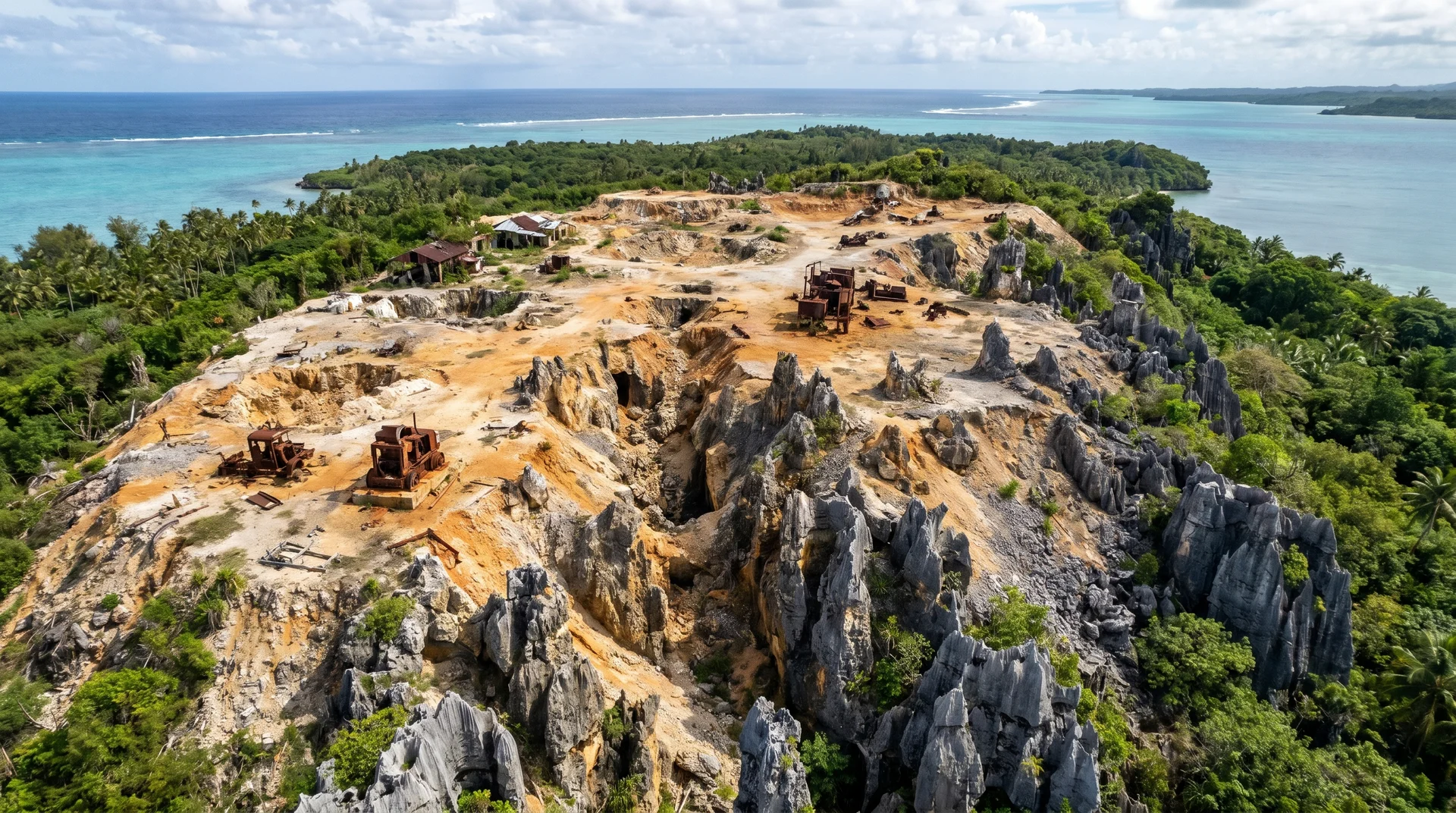
The ground on Command Ridge is not a traditional hiking trail. The surface is dominated by deep, mined-out phosphate pinnacles - the same jagged terrain that defines the entire Nauru Topside plateau, sharp limestone pillars created by decades of strip mining. These formations make every step a deliberate decision.
Step carefully and always test your footing before shifting your weight. The gaps between the rocks are often filled with deceptive layers of dead leaves and vines. Open-toe shoes are a severe safety hazard and thick-soled hiking boots are mandatory, not optional. A misstep results in a severe laceration or a twisted ankle, and emergency access to this specific area is effectively impossible given the landscape. The terrain also makes it impossible for any vehicle to approach the historical sites directly.
The mosquitoes on Nauru are particularly aggressive, especially around stagnant water pooling inside the countless buried fuel drums scattered throughout the area. Wear long, breathable trousers and apply a heavy-duty DEET-based repellent before you even leave your vehicle. The heat reflects intensely off the exposed rock, and the lack of strong airflow among the dense pinnacles makes the humidity stifling.
Other Notable WWII Sites Near Command Ridge
The Japanese Prison Near Buada Lagoon
On the road towards Buada Lagoon, a sandy path on the left leads through a narrow gap in the trees just past the "Welcome to Buada" sign. Following the well-worn dirt track, which traces the line of an old phosphate railway, brings you to the ruins of an isolated Japanese wartime prison. The path is striking but heavily mosquito-infested.
The concrete cells are small, dark, and slowly being reclaimed by the jungle. Three isolated cells remain structurally identifiable, built to house enemies of the Japanese administration. The structural decay is significant, and the surrounding canopy makes this one of the most heavily mosquito-infested areas on the island. Timing the visit to early morning reduces both the heat and the insect activity.
Ewa Cave and Coastal Bunkers
Drive along the perimeter road near the Capelle store complex on the northwest side of the island. A break in the cliff line reveals a cave system known as Ewa. The cave opening is partly lined with horizontal fuel drums cemented together, originally forming a blast shelter against air attack.
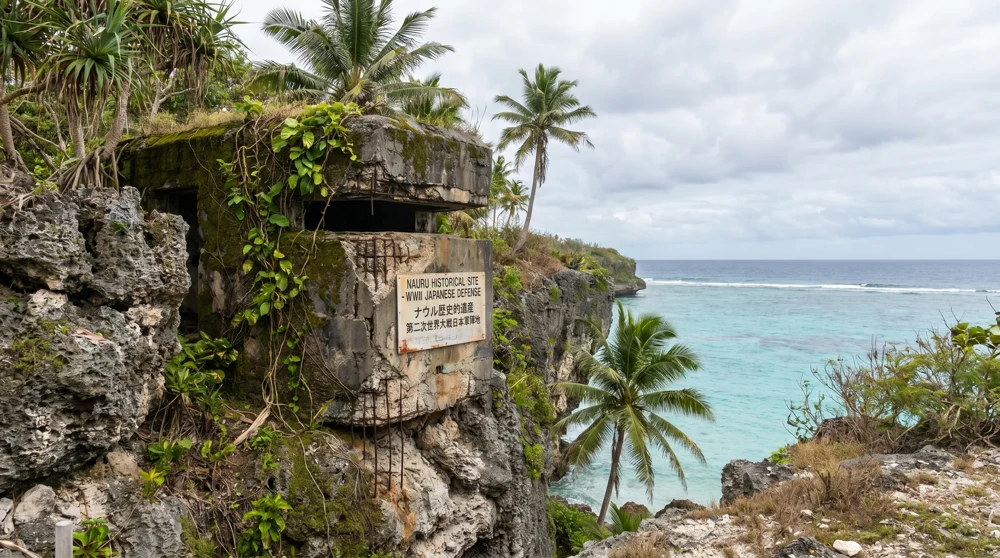
Beyond the shelter lies a steep vertical drop to the cavern floor. The bottom is littered with uneven boulders and debris that has fallen through a hole in the cave roof over the decades. Do not descend without ropes and an experienced local companion. All along this same western coastline, concrete blockhouses and machine-gun nests remain embedded directly into the ocean-facing cliffs, positioned to cover every potential landing beach.
The Coastal Pillboxes
Circling the island's single 19-kilometre perimeter road reveals two additional concrete defensive structures on the east coast. These pillboxes were positioned to provide overlapping fields of fire across the most accessible landing zones. Unlike the Command Ridge installations, these coastal positions are fully exposed to weather and have deteriorated more severely, but their construction details, including the narrow firing slits and thick reinforced-concrete walls, remain clearly visible.
Practical Tips for Visiting
- Guide: Hiring a local guide is strongly recommended for Command Ridge and the prison ruins. The sites have no signage, no marked paths, and the entry points to the bunkers are genuinely invisible without prior knowledge.
- Timing: The dry season runs from May to October; the complete seasonal breakdown including monthly rainfall figures is in the best time to visit Nauru guide. November through February brings heavy monsoon conditions, high humidity, and significantly reduced visibility in the tunnels due to water ingress.
- Flights: Nauru Airlines operates roughly twice-weekly services from Brisbane. Return fares run approximately 1,700 AUD, and planning several months ahead is advisable given limited capacity. Before you go, visiting Nauru has an overview of practical logistics including cash, transport, and connectivity.
- Time on site: Allow a minimum of three to four hours for Command Ridge alone. A full day is needed to combine the ridge, the Buada prison, and the coastal sites.
- What to bring: Thick-soled hiking boots, heavy-duty flashlight with spare batteries, DEET repellent, at least two litres of water per person, and long trousers.