Navigating a 75-kilometer trail through a tiny, doubly landlocked country with no airport requires precise logistical planning, especially when Alpine weather shifts without warning. Many hikers underestimate the cumulative daily elevation gains and the notoriously high cost of food along this route. Here are the exact transport connections, realistic budget figures, and pacing strategies you need to successfully cross the sixth-smallest country in the world on foot.
- Total Distance: 75 kilometers (46.6 miles)
- Total Elevation: ~2,000m ascent / ~2,000m descent
- Duration: 3 to 5 days
- Difficulty: Moderate
- Best Time: Mid-May to September
- Starting Point: Balzers (Swiss border)
- Ending Point: Schaanwald (Austrian border)
What to Expect on the Trail
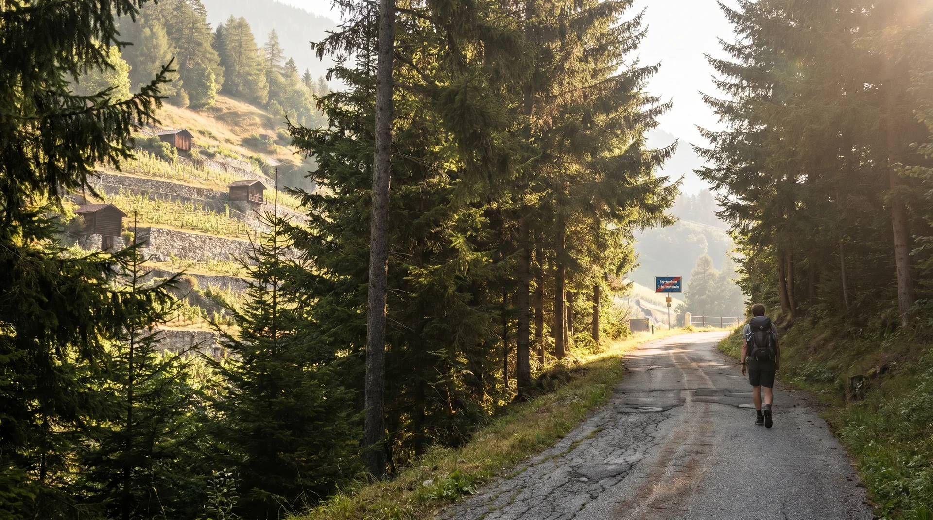
The terrain frequently shifts between paved rural roads, dense woodland tracks, and sharp ascents into the Alpine foothills. Forests cover nearly 42% of Liechtenstein, meaning you spend a significant portion of the hike walking under heavy, shaded canopies. The route is hillier during the initial southern stages and gradually flattens out as you move north toward the Austrian border.
Liechtenstein holds the distinction of having the densest network of hiking trails in Europe, and it shows. Even in the small towns and villages, signed paths cut through residential gardens and vineyard rows in ways that repeatedly catch you off guard. Cows and vineyards intermix with suburban streets far more often than you'd expect from a European nation of just 38,000 people.
Navigation is generally straightforward. Red and blue "Liechtenstein-Weg" signposts mark every major junction, turn, and forest track. Vegetation sometimes obscures the signs on wider roads, making an offline GPS map essential for quick course corrections. The critical point: town and village sections demand extra attention. Some intersections have no directional signs at all, and a wrong turn in a residential area can cost you 20 minutes before you realize the mistake.
Best Time to Hike
Weather in the Central European Alps is highly unpredictable, and the warmest months in Liechtenstein are also the wettest. The country experiences an average annual rainfall of 1,000mm, similar to the UK.
Late May through September offers the most comfortable hiking temperatures, ranging between 15°C and 24°C. February is technically the driest month, but daily highs hover around a freezing 4°C, and heavy snow often blocks the higher elevation paths. Bring reliable waterproof gear regardless of the season, and check the forecast each morning before you leave accommodation - conditions can change within a single stage.
For a deeper look at seasonal patterns and what each month looks like on the ground, the best time to visit Liechtenstein covers weather windows, crowd levels, and event timing in detail.
Planning Your Stages
The Classic 5-Day Route
The official tourism board divides the trail into five manageable stages. This pace allows ample time for museum visits, long lunches, and leisurely photography.
| Stage | Route | Distance | Elevation |
|---|---|---|---|
| Day 1 | Balzers to Triesenberg | 15.7 km | +535m / -137m |
| Day 2 | Triesenberg to Vaduz | 10.4 km | +256m / -699m |
| Day 3 | Vaduz to Nendeln | 13.4 km | +460m / -467m |
| Day 4 | Nendeln to Ruggell | 14.8 km | +252m / -271m |
| Day 5 | Ruggell to Schaanwald | 19.4 km | +411m / -377m |
Day 2 is intentionally short - use the extra hours to walk up to Vaduz Castle and explore the old town properly. The trail passes directly beneath the castle approach road, and the viewpoints from the pedestrian path winding through the historic quarter give you the best angles on the palace against the Alpine backdrop.
The Accelerated 3-Day Route
Experienced hikers comfortable with walking over 20 kilometers a day can condense the route. This strategy saves two nights of expensive hotel bookings and spaces the daily mileage more evenly.
| Stage | Route | Distance |
|---|---|---|
| Day 1 | Balzers to Vaduz | 26.1 km |
| Day 2 | Vaduz to Bendern | 26.8 km |
| Day 3 | Bendern to Schaanwald | 25.2 km |
The 3-day version has a real cost: you lose the ability to stop at anything that requires more than 15 minutes. Historical sites with limited opening hours become impossible to factor in, and the final stretch into Schaanwald on Day 3 (~25 km) arrives with tired legs. Only attempt this pace if you have recent multi-day hiking experience.
(https://www.thetripverdict.com/getting-around-liechtenstein) for the final leg."]
Logistics and Practicalities
For a full overview of visiting Liechtenstein including entry requirements and practical tips, check our dedicated guide.
How to Get to the Starting Point
Liechtenstein has no airport and no major central train station. You must fly into Zurich (ZRH) in Switzerland and rely on cross-border trains and buses. Note that the Schaan-Vaduz stop on the ÖBB Vorarlberg line is active but handles limited regional connections, not direct services from Zurich. The journey from Zurich Airport to the trailhead at Balzers takes roughly 1.5 to 2 hours depending on connections.
Take the train from Zurich HB to Sargans Bahnhof - a journey of roughly one hour. Purchase your train tickets via the SBB Mobile app to avoid ticketing machines. Exit Sargans station, head to Stand C, and catch the number 11 bus to the "Balzers Höfle" stop. The official trailhead on Neue Churerstrasse is a flat, 15-minute walk from there.
For context on combining this trail with a broader Swiss itinerary, a Liechtenstein day trip from Zurich covers the same rail connection in detail and works well if you want to scout the trailhead before committing to the full hike.
At the end of the trail in Schaanwald, catch the number 11 bus back to Sargans. Alternatively, take bus 13, N1, or N2 to Schaan Bahnhof, switch to a bus for Buchs SG, and board a direct train back to Zurich.
Accommodation and Luggage Transport
Hostels do not exist along this route. You will rely entirely on hotels or private rentals, which maintain exceptionally high standards but carry heavy price tags, averaging around CHF 150 per night. The Airbnb option saves almost nothing - prices match hotels but rarely include breakfast, which matters when you need fuel for a 15-20 km day.
Always book rooms that include a buffet breakfast to fuel your morning miles. Many hotels operate without front desk staff, utilizing automated touchscreen kiosks outside the main entrances. Keep your booking reference numbers easily accessible, as these calibration-sensitive screens often require a few attempts to register your details. Check your hotel's specific check-in instructions in advance - several properties send instructions via email that are easy to overlook.
Liechtenstein Tourism operates a dedicated luggage forwarding service that moves your bags from hotel to hotel while you hike. Luggage must be dropped off at reception by 9 AM, and it arrives at your next hotel by 5 PM at the latest. The service covers one bag per person up to 20 kg, and bookings must be arranged in advance through the official tourism portal alongside your accommodation itinerary. Note that Airbnb bookings are not eligible for luggage transport.
Food and Daily Budget
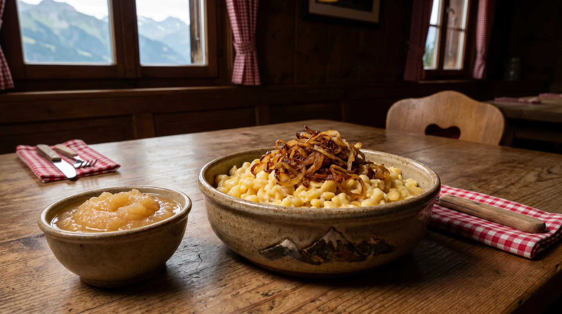
Dining out in Liechtenstein requires a robust budget. A standard dinner consisting of a mixed salad, a simple pasta dish, and a beer averages around CHF 45. A cup of coffee costs roughly CHF 6.50.
Restaurant choice drops sharply once you leave Vaduz. Plan your evening meal destinations for Days 3, 4, and 5 before you set off each morning - turning up in a small village at 7 PM with no reservation often means limited options. The trail passes through all 11 municipalities, so you are never more than a few kilometers from a café or shop during daylight hours.
As a landlocked nation, fresh seafood is practically non-existent on local menus. Italian cuisine heavily influences the local food scene, providing excellent and widely available vegetarian options like Schlutzkrapfen (stuffed pasta) and rich tomato ragouts. Supermarkets like Coop or Aldi (just across the Swiss border) offer affordable alternatives for trail snacks and packed lunches.
Water fountains containing clean, drinkable Alpine water are common along the paths, eliminating the need to carry heavy water volumes.

Essential Gear and Navigation
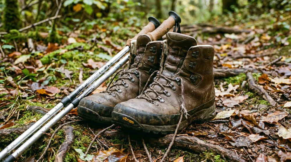
Keep your backpack as light as possible. Since you are staying in hotels and passing through populated municipalities daily, you do not need a tent, sleeping bag, or heavy cooking gear.
Footwear: Sturdy hiking boots with ankle support and good grip rather than lightweight trail runners. While much of the route uses paved roads, the steep woodland descents - particularly toward Nendeln - generate the kind of lateral pressure that trail shoes handle poorly. Break them in thoroughly before arrival.
Clothing: Moisture-wicking merino wool shirts and packable waterproof layers (both jacket and trousers). Even in July, afternoon thunderstorms roll in from the Rhine valley with little warning.
Navigation and power: Download the Footpath app for free GPS route tracking that works offline once loaded. The LIstory app provides interactive historical context at 148 waypoints along the trail, but it drains battery exceptionally fast - keep your phone in flight mode between waypoints and carry a high-capacity portable power bank. Using both apps simultaneously empties a standard smartphone battery before the day's stage ends.
The trail's endpoint in Schaanwald arrives without ceremony or markers. There is no finish line, no information board, no café waiting at the border. If you want a sense of completion, photograph the border sign and arrange your return bus in advance.
Historical Highlights Along the Route
The Liechtenstein Trail passes through more than a thousand years of compact Central European history. Three sites stand out for the quality of the experience rather than just the spectacle.
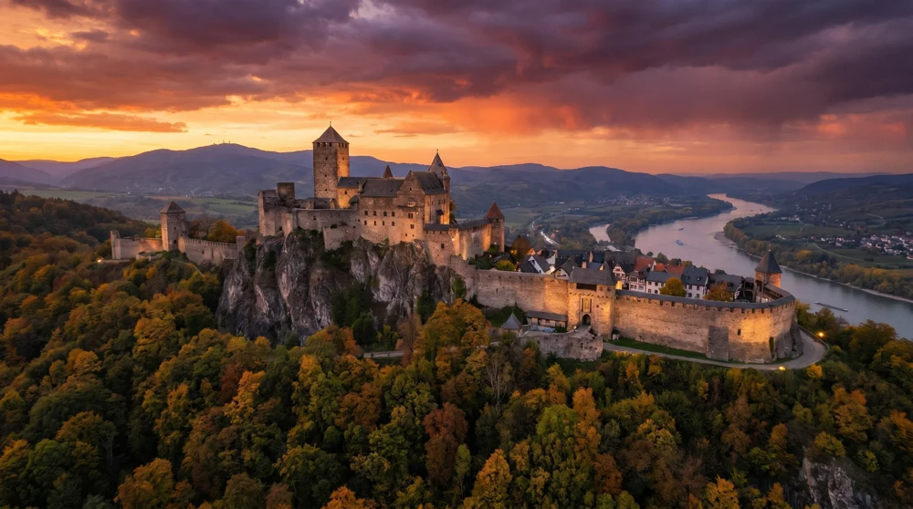
**Gutenberg Castle** - Visible within the first five minutes of the hike, this imposing medieval fortress sits 70 meters above the town of Balzers. The short diversion up the hill offers sweeping views of the Rhine Valley, even if you arrive outside the strict Sunday opening hours. The castle has been continuously inhabited since the 12th century, making it one of the best-preserved medieval complexes in the Alpine region.
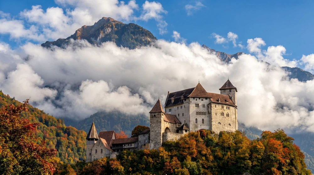
Vaduz Castle Viewpoints - The iconic residence of the Prince of Liechtenstein dominates the capital's skyline. The pedestrian route winding through the old district, past the 14th-century Red House, provides the best vantage points for photographing the castle against the snow-capped Alpine backdrop. The castle itself is not open to the public, but the approach paths and lower terraces are freely accessible. The Fuerstensteig ridge walk begins just above Vaduz and offers an entirely different perspective on the principality from the high ridgeline.
Bendern Church Hill - A crucial historical site overlooking the Rhine Valley. In 1699, the people of Liechtenstein gathered in this exact square to pledge allegiance to the Prince. The Gothic-style parish church and the adjacent Governor's Office feature striking stepped gables and candy-striped shutters. The hill sits at the midpoint of the trail and offers a natural break point with views stretching into Switzerland and Austria simultaneously.