Liechtenstein may be one of the smallest countries in the world, but its alpine terrain rivals the grandest landscapes in Europe. If you are looking for an outdoor adventure that combines sheer adrenaline, impeccable trail engineering, and panoramic views stretching across three countries, the Fuerstensteig (Fürstensteig) ridge walk is your definitive destination.
Carved directly into the vertical limestone cliffs of the Rätikon mountain range in 1898, this historic path is not a casual Sunday stroll. It is a thrilling, highly exposed alpine classic that demands respect, proper preparation, and a steady foot. Below is everything you need to know to safely navigate this bucket-list Liechtenstein hike.
Essential Trail Info
Before you lace up your boots, look at the core physical metrics of the standard Fuerstensteig loop. Having these figures in mind will help you pace yourself and allocate enough time for safe navigation.
- Trail Distance: Approximately 6 km (short loop via Bärgällä Alp) or up to 12 km if extended to the Drei Schwestern (Three Sisters) mountain chain
- Time Needed: 3 to 3.5 hours for the short loop; 5.5 to 6 hours for the full Drei Schwestern extension
- Elevation Gain: 608 metres of vertical ascent for the short loop; up to 1,260 metres for the extended technical route
- Highest Point: 1,929 metres on the standard Fürstensteig path; 2,052 metres near Drei Schwestern
- Trail Difficulty: Classified as Hard / T3 (Difficult Alpine Hiking)
- Key Requirements: Absolute sure-footedness, sturdy ankle-support footwear, no fear of heights, and solid alpine experience
The small parking lot at Alpe Gaflei fills quickly on summer weekends. Arrive before 9 AM or take the bus if you want a guaranteed spot. There are clean public restrooms at the trailhead, and the Gaflei-Stuba restaurant is open for a coffee or meal before or after the hike.
How to Get to Alpe Gaflei
Your journey begins at Alpe Gaflei, situated at an altitude of 1,400 metres. Getting to the trailhead is straightforward, whether you choose to use Liechtenstein's efficient public transit system or drive yourself up the mountain.
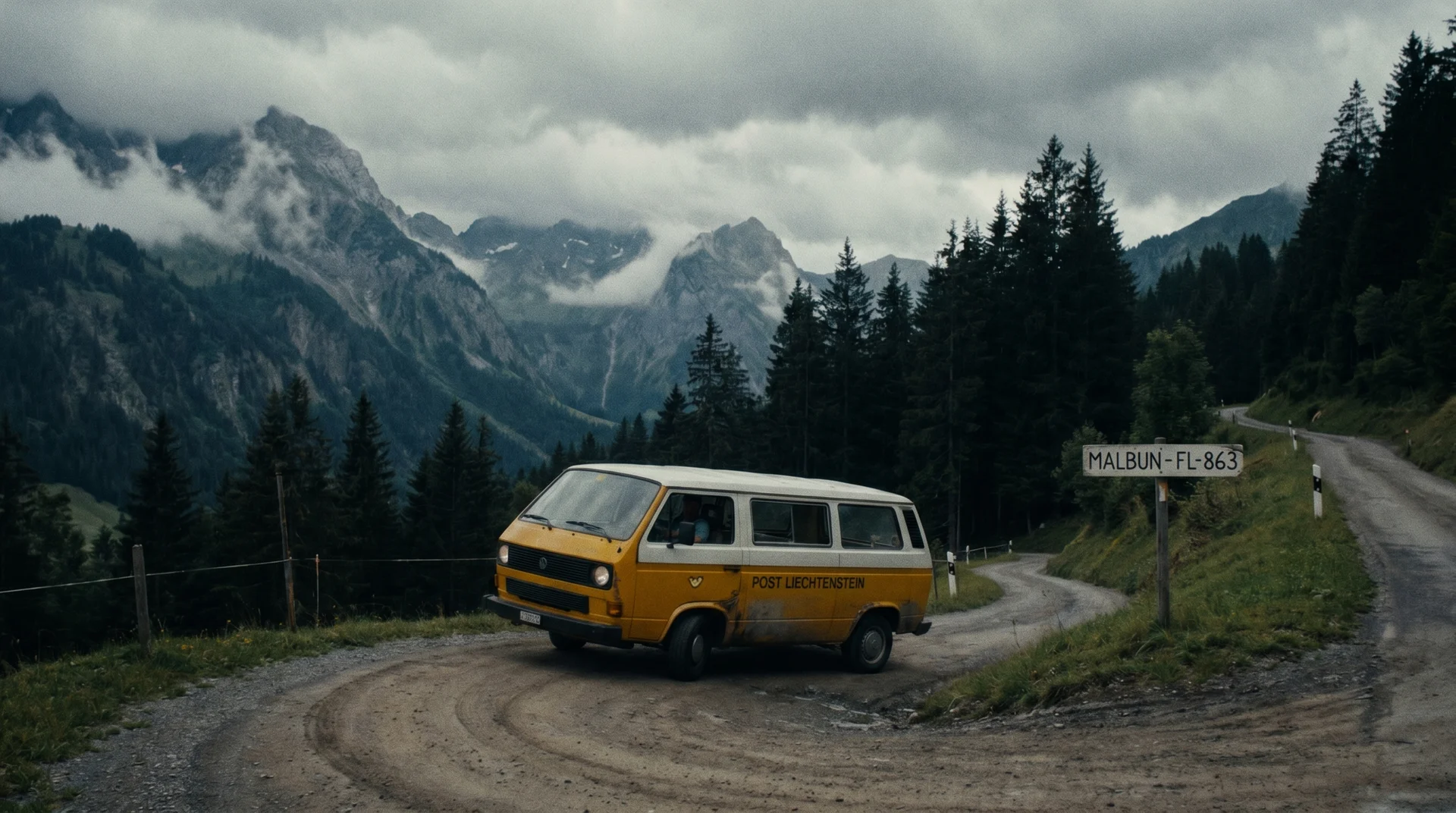
If you are traveling by public transport, take Liechtenstein Bus 21 from the capital city of Vaduz up to the mountain village of Triesenberg. From Triesenberg, transfer directly to Bus 22, which climbs the narrow, winding switchbacks all the way to the terminal stop at Alpe Gaflei. The bus schedule is synchronized, but check the LIEmobil app for seasonal weekend timings before you go.
For those driving, the route from Vaduz takes about 20 minutes. Follow signs toward Triesenberg, then continue upward following the markers for Gaflei. Once you arrive, there is a designated parking lot right next to the trailhead. The road itself is narrow and winding, and some drivers find it more nerve-wracking than the trail. If mountain roads are not your thing, the bus is an excellent option.
The Trail Experience: What to Expect
The Fuerstensteig is beautifully varied, shifting from serene alpine pastures to stark, thrilling drops within the span of a single kilometre. The hike breaks into three distinct phases.
The Ascent to the Gaflei Saddle
Leaving the Alpe Gaflei parking lot, the trail introduces you gently to the terrain. You walk through lush green meadows and gentle, pine-scented slopes. The path initially leads north, gradually growing steeper as you approach the massive rock faces of the Alpspitz. Within roughly 20 to 30 minutes, the soft grass yields to loose scree and rugged limestone blocks. This is your warm-up before you reach the official entry point of the cliffside path.
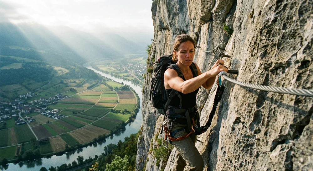
Navigating the Exposed Wire Rope Sections
This is where the true thrill of the Fuerstensteig begins. The path narrows significantly, transforming into a ledge carved directly out of the vertical cliff face. To your left is solid rock; to your right is an immediate, breathtaking drop looking down into the Rhine Valley and across to the Swiss Alps.
While the exposure is intense, the trail is highly engineered. The most precarious and narrow sections are fully secured with heavy-duty steel wire ropes fixed into the rock face, which you use as handrails to stabilize your balance. Despite the presence of these safety cables, there are no safety nets or barriers. Absolute concentration with every step is required, particularly when loose rock dust coats the stone ledges. A real-life note worth knowing: the descent via the Bärgällä Alp switchbacks is steep and slippery in places. Ascending via the Fürstensteig cliffside and descending via the switchbacks is the recommended direction.
Some hikers on the longer route continue north toward Garsellikopf (2,105 metres) and the Drei Schwestern chain. This section involves extended cable-assisted climbing that is technically harder than the famous cliff face section lower down. Pace yourself accordingly if you are planning the full day.
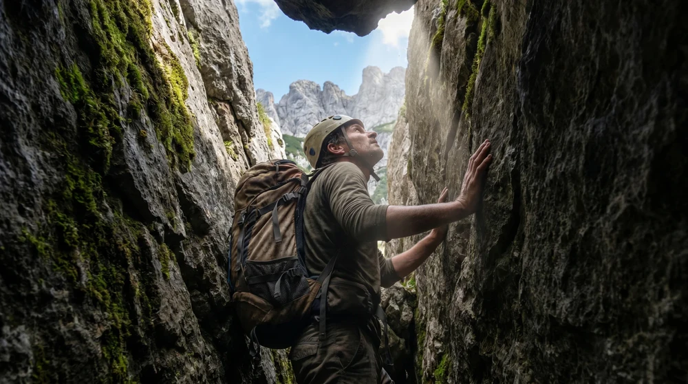
The "Chemi" Chimney and the Summit Panorama
After navigating the cliff faces, the trail directs you to a distinct rock formation known as the "Chemi" (the Chimney). This is a steep, narrow rock couloir where you climb upward through a natural cleft in the mountain, occasionally using your hands for balance.
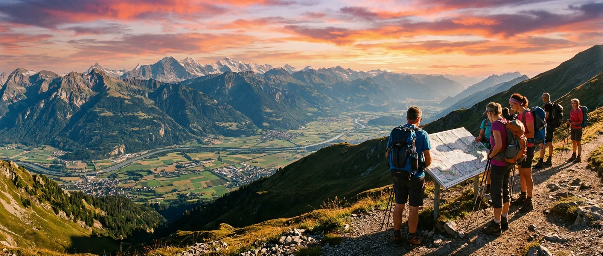
Once you clear the Chimney, you emerge onto the Gaflei Saddle (Gafleisattel). The sudden change in perspective is genuinely awe-inspiring. The jagged spires of the Drei Schwestern chain stand directly before you, and you can see the entire Liechtenstein mountain panorama, the rolling Vorarlberg alpine landscapes of Austria, and on a clear day even a glimpse of Lake Constance. At the saddle, hikers can return via the gentle Bärgällä Alp pasture, or those with stamina continue along the high ridge toward the Three Sisters. There is also a tradition worth knowing about: hikers who reach the summit area are often invited to sign a guestbook kept by other visitors. It is a small, charming community ritual that surprises most people on their first time.
Best Time to Visit and Weather Conditions
The official hiking season runs from June through October. Check the best time to visit guide for seasonal conditions. Timing your trek carefully is not optional; it directly affects your safety.
In late spring (May to early June), snow patches routinely cling to the narrow ledges and the inside of the Chemi chimney well into June. Attempting the path before the snow clears without specialized winter mountaineering equipment is dangerous and not recommended. Always check the local mountain weather forecast on the Liechtenstein Alpine Club's website before you go. If rain, high winds, or dense fog are predicted, postpone the hike. Wet limestone becomes incredibly slick, and fog eliminates the visual depth perception you need to navigate exposed drops safely.
Weekdays in July and August offer the most reliable weather windows, and the trail is noticeably less crowded than on weekends. September is arguably the best overall month: stable weather, lower crowds, and the alpine meadows still carrying their summer colour.
Required Gear and Mountain Safety
Your gear choice should prioritize stability and protection.
Footwear: Leave your low-cut trail runners at home. You need sturdy, high-cut hiking boots with a deep, high-traction Vibram sole. The ankle support is vital when crossing loose scree.
Clothing: Weather changes rapidly above 1,800 metres. Pack a lightweight, windproof, and waterproof shell jacket. Even on a warm summer day, the wind whipping over the mountain ridges can drop the temperature significantly.
Trekking Poles: Adjustable trekking poles are beneficial for saving your knees during steep descents, but collapse them and strap them to your pack during the narrow wire-rope sections where you need both hands free to grip the cables.
Hydration: There are no natural springs, water refill stations, or alpine huts along the ridge itself. Carry at least 2 litres of water per person before leaving the Alpe Gaflei parking lot.
Optional Safety Gear: While the Fuerstensteig is a hiking trail, not a technical via ferrata requiring a harness, some hikers prefer to wear a climbing helmet due to the minor risk of natural rockfall from the cliffs above. This is a reasonable precaution, particularly if you are sensitive to the sound of rocks shifting overhead.
Dogs: Taking dogs on the standard Fuerstensteig path is highly discouraged. The extreme exposure, sheer vertical drops, and narrow stone ledges present severe risks even for agile, leashed dogs. It is best to leave your dog behind for this hike.
By respecting the terrain, monitoring the weather, and pacing your ascent, the Fuerstensteig rewards you with one of the most memorable ridge walks in the entire alpine region. The path is well-marked throughout, and the combination of cable-secured exposure and genuine summit panoramas makes it a trail that stays with you long after you have driven back down the mountain.