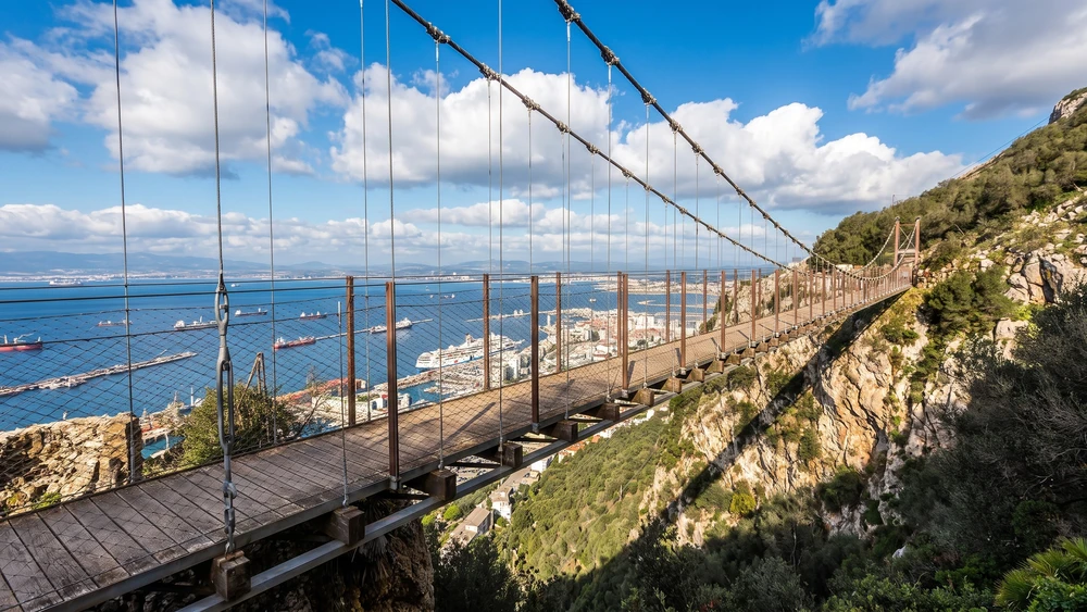
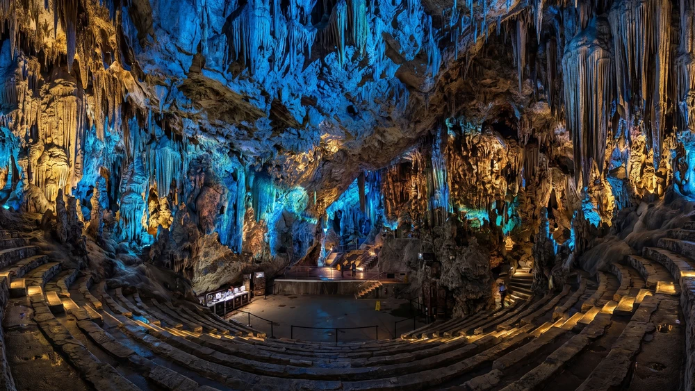
If you look at standard travel brochures for Gibraltar, you will find endless mentions of the Barbary macaques, the main chamber of St. Michael's Cave, and the standard cable car route. But for history buffs, military architecture enthusiasts, and those who prefer the quiet satisfaction of finding places left out of the mainstream itineraries, the true magic of the Rock lies in its layers of defensive infrastructure.
From late 18th-century siege bastions and Victorian-era coastal batteries designed to repel ironclads, to the vast underground networks carved out during World War II, Gibraltar is essentially a limestone battleship frozen in time.
This walking guide connects the Rock's lesser-known, off-the-beaten-path military batteries and panoramic viewpoints into a cohesive, geographic journey. We will start at the southern tip, trace the coastal defenses, ascend through challenging mid-level passes, and finish at the highest peaks before descending back to the northern border.
Part 1: The Southern Defenses & Coastal Bastions
Harding's Battery & Harding's Observation Post
Our route begins at **Europa Point**, the southernmost tip of Gibraltar. While most tourists immediately head to the Trinity Lighthouse, you should turn your attention to the massive artillery piece nearby. Harding's Battery, named after Sir George Harding (Chief Engineer in 1844), is a restored Victorian fortification that holds a massive 12.5-inch 38-ton rifled muzzle-loading (RML) gun.
Just adjacent to the gun emplacement is Harding's Observation Post. Underground, the old magazine chambers have been converted into a small, highly informative visitor exhibition detailing the defense of the southern coastline.
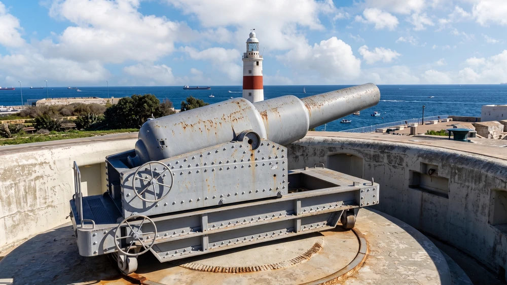
Practical access: This area is entirely flat and free to access. It serves as an excellent warm-up spot before you begin the physical climbs further north.
General Sikorski Memorial
Strolling slightly west from the battery along the Europa Point plateau, you will encounter the General Sikorski Memorial. Dedicated to General Wladyslaw Sikorski, the commander-in-chief of the Polish Army and Prime Minister of the Polish government-in-exile, this monument marks a tragic moment in WWII history. In July 1943, Sikorski's Liberator aircraft crashed into the sea immediately after taking off from the Gibraltar runway, killing him and fifteen others.
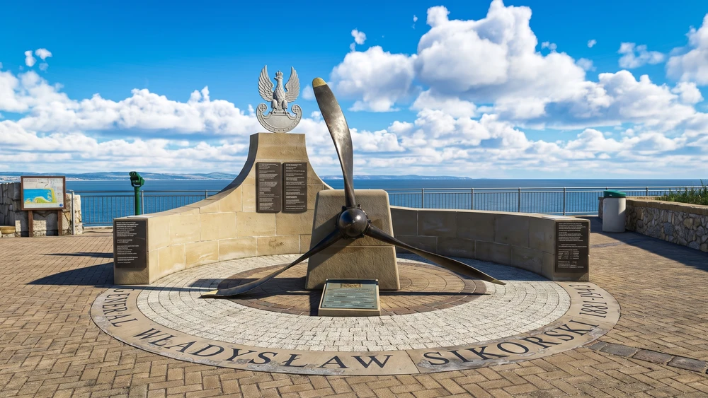
Practical access: The memorial offers a somber moment of reflection paired with sweeping views across the Strait to the Rif Mountains of Morocco. It is open to the public year-round.
Parson's Lodge Battery
Leaving Europa Point, head northwest along Europa Road toward Rosia Bay. Perched dramatically on a limestone promontory overlooking the bay sits Parson's Lodge Battery. This site is an architectural palimpsest, showing modifications that span from Spanish Moorish fortifications to British Victorian upgrades and WWII searchlight emplacements. It was built specifically to prevent enemy landings at Rosia Bay, the historic home of the Royal Navy's Mediterranean Fleet and the exact location where HMS Victory anchored carrying the body of Admiral Nelson after the Battle of Trafalgar.
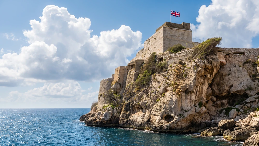
Practical access: Managed by the Gibraltar National Museum, this site is usually accessed via specialized guided tours booked in advance. The terrain inside involves steep stone stairwells and narrow passages, so sturdy footwear is highly recommended.
100-Ton Gun at Napier of Magdala Battery
A short walk up from Rosia Bay brings you to the Napier of Magdala Battery. Here lies one of the rarest engineering marvels of the late 19th century: the 100-Ton Gun.
Built by Sir W.G. Armstrong & Co. in Newcastle, this colossal muzzle-loader was one of only eight ever manufactured (four for the British Army and four for Italy). It was installed in 1882 to counter the threat of heavily armored Italian warships entering the Bay of Gibraltar.
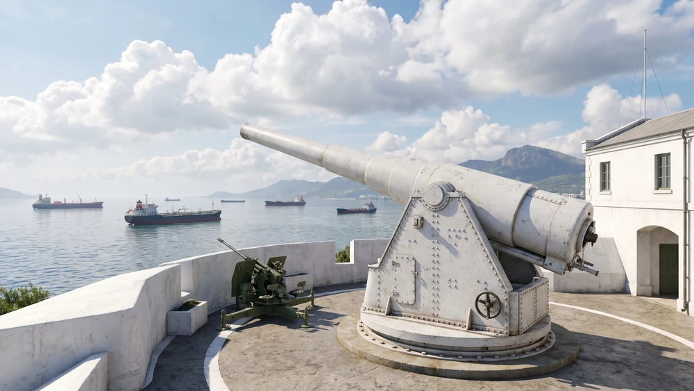
Practical access: The site is enclosed and included in the standard £30 Upper Rock Nature Reserve pass, even though it sits outside the main reserve boundaries. The courtyard is flat, but stepping down to view the massive subterranean steam engine mechanisms, which were used to rotate and load the gun, requires navigating a small flight of stairs.
Camp Bay Tunnel & Queen's Balcony
From the battery, loop back down toward the coastline via the coastal road to pass through the Camp Bay Tunnel. Carved straight out of the sheer sea cliffs, this rugged tunnel reveals the immense logistical challenges the military faced when moving troops and artillery along the jagged western shore. Just above the coastal shelf sits the Queen's Balcony, a vantage point used historically by lookouts to monitor maritime traffic entering the Bay of Gibraltar from the Atlantic.
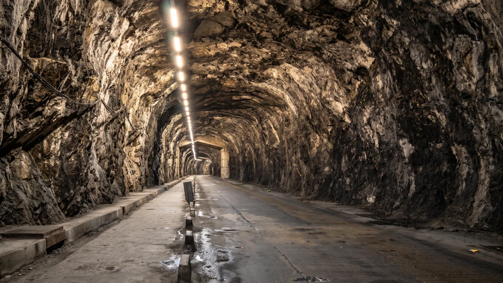
Practical access: The tunnel is a public thoroughfare with a pedestrian sidewalk, though it can feel tight when buses pass through. The viewpoints around Camp Bay offer a wonderful, refreshing sea breeze after a morning of walking.
Part 2: The Mid-Level Ascents & Strategic Gorges
Woodford's Battery & Buffadero Battery
Now, the real climbing begins. Heading inland toward the Windmill Hill Flats via the southern access paths, you will move away from the tourist paths and into the territory of early Victorian engineering. Woodford's Battery and the nearby Buffadero Battery were constructed to defend the high plateaus directly above Europa Point. Buffadero Battery, hidden amidst thick Mediterranean scrub, still retains its defensive layout designed to ambush any invading forces attempting to scale the southern cliffs.
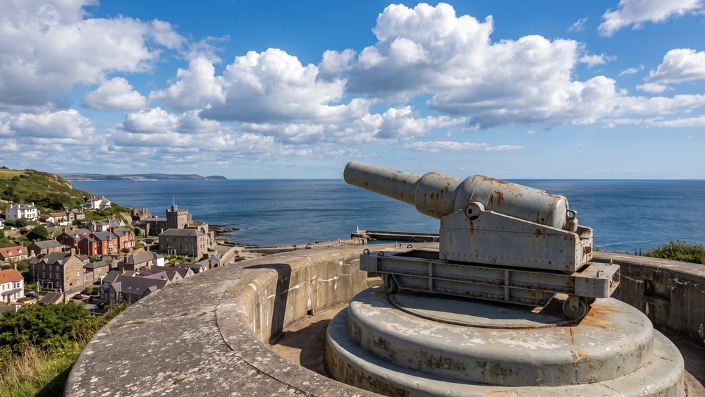
Practical access: The trails heading up to Windmill Hill Flats are uneven, steep, and can become quite overgrown in the spring. Watch your step for loose limestone rock. Parts of Windmill Hill remain active military training zones, so respect all Ministry of Defence boundaries and stay strictly on marked footpaths.
Edward VII Battery
Continuing your ascent toward the mid-levels of the Rock, look out for the ruins of Edward VII Battery. Tucked away from the main thoroughfares, this site represents the transition of Gibraltar's defenses into the early 20th century. It offers an excellent case study in how the British military constantly repurposed older stone ramparts to accommodate modern, quick-firing artillery pieces.
Practical access: This site is largely unmanaged and rarely visited. Access paths are narrow and rocky, making it a perfect spot for photography enthusiasts looking for an isolated shot of military ruins contrasted against wild flora.
Devil's Bellows
As you traverse the southern ridges toward the Upper Rock, you will pass through the Devil's Bellows. This deep, narrow gorge acts as a natural wind tunnel, earning its dramatic name from the fierce drafts created when the easterly Levante wind hits the Rock. The military heavily fortified this natural gap, recognizing that it formed a bottleneck for anyone trying to navigate the upper ridges.
Practical access: The wind here can be genuinely startling, even on warm days. Hold onto your hats, cameras, and gear securely as you walk through this exposed section.
Devil's Gap Battery
Shifting toward the western face of the Rock via the lower terraces, you will reach Devil's Gap Battery. Positioned roughly 130 meters above the town, this battery played a critical role during WWII, as its guns were positioned to fire directly onto the shipping lanes of the bay. Today, it is famous among hikers for the Union Jack Steps, a long, steep stone staircase painted with the British flag that leads down into the old town.
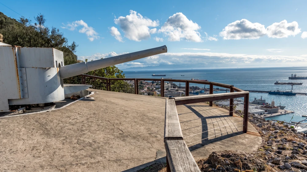
Practical access: Devil's Gap serves as one of the primary pedestrian entry points to the Nature Reserve. It is a grueling, continuous uphill climb if you start from the town level, but makes for an excellent descending path if you follow this route in reverse. The stone steps can become quite slippery when damp.
Part 3: The High Summits
Spur Battery
Now we enter the high-altitude sector of the route. Perched on the southern ridge of the Upper Rock, Spur Battery is famously situated directly above the Mediterranean Steps trail. During World War II, this site housed a massive 9.2-inch breech-loading gun. In a remarkable feat of wartime engineering, the entire gun barrel was dismantled and lowered down the sheer face of the Rock in the 1970s during a military operation known as Project Vitello.
Practical access: The site offers an incredibly dramatic drop-off view of the eastern coast. Because the nearby Mediterranean Steps are subject to sudden closures due to rockfall hazards, always check local safety alerts before attempting to explore the adjacent paths.
Princess Caroline's Battery & the Military Heritage Centre
Before pressing on to the summit, it is worth a short detour to Princess Caroline's Battery, tucked into the Upper Rock above the Moorish Castle. Its old armoury and accommodation blocks now house the Military Heritage Centre, a small indoor museum displaying relics spanning the 18th century through to the modern garrison era. It is one of the only fully roofed exhibits on this route, making it a useful shelter stop if the Levante weather turns.
Practical access: Included within the standard Nature Reserve pass, the centre keeps the same opening hours as the wider reserve and adds only a few minutes to the main route.
O'Hara's Battery
Located at the absolute highest point of the Rock of Gibraltar (426 meters above sea level), O'Hara's Battery is the crown jewel for military historians. Named after Governor Charles O'Hara, the site features a fully preserved, massive 9.2-inch coastal defense gun that remains pointing out over the Strait. Standing next to this steel giant, you realize that you are looking at the ultimate evolution of the Rock's artillery defenses, which remained active right up through the Cold War.
Practical access: The final approach up O'Hara's Lane is exceptionally steep. Because of its extreme elevation, this battery is frequently enveloped by the dense, damp Levante cloud cap. If you find yourself caught in the cloud, wait 15 to 20 minutes; the wind patterns change rapidly, often clearing the summit to reveal jaw-dropping views of two continents simultaneously.
Part 4: The Northern Threshold
Gibraltar Airport Runway Walkway
After descending the northern slopes past the Moorish Castle, your walk concludes with a highly unusual experience: the Gibraltar airport runway. Historically, Winston Churchill Avenue was the only road connecting Gibraltar to Spain, requiring pedestrians and cars to cross directly over the active tarmac. While vehicle traffic has been redirected through a modern tunnel system, a dedicated pedestrian walkway still allows you to cross the runway on foot when flights are not taking off or landing. For the wider border-crossing rules that apply once you reach this point, see this guide to crossing the Gibraltar border.
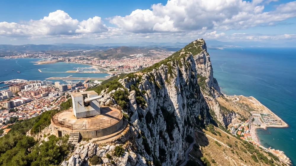
Practical access: This is an active, high-security aviation zone. Always follow the instructions of the border guards and light signals explicitly. If the barriers go down, you will have the unique privilege of standing just meters away as a commercial jet lands right in front of the sheer northern face of the Rock.
Final Strategy for the Trail
To get the most out of this highly specific route, you need to plan ahead differently than the average tourist.
- Water strategy: There are almost no commercial kiosks or shops once you leave the Europa Point area and enter the mid-level military paths. Carry at least two liters of water per person.
- Footwear: Leave the running shoes or sandals behind. The paths connecting sites like Woodford's and Edward VII batteries are unpaved limestone tracks that require proper hiking boots with solid ankle support.
- Timing: Start your walk no later than 08:30 AM. By starting early, you will clear the exposed lower coastal batteries before the midday Mediterranean sun hits, and you will reach the upper summits long before the afternoon taxi tours begin to crowd the narrow roads.
Before setting out, it is worth reading up on Gibraltar's essentials and confirming current opening times for the Upper Rock Nature Reserve, since access to several of these batteries is bundled into that single pass.