Most people drive for hours to Centralia expecting to walk the famous Graffiti Highway or witness Hollywood-style flames, only to find a massive mound of dirt and a few overgrown side streets. Understanding what actually remains, and the very real subterranean dangers still active today, can save your trip from ending in disappointment or a trespassing fine.
- Status: Near-abandoned borough (underground mine fire active since 1962)
- Entry fee: Free (public municipal roads only)
- Graffiti Highway: Permanently buried (April 2020) and heavily patrolled
- Safety risk: High risk of toxic gases (carbon monoxide) and sudden ground subsidence
- Time needed: 30-45 minutes
- Location: Columbia County, PA (intersection of Route 61 and Route 42)
The 1962 Coal Mine Fire: How the Earth Caught Fire
The tragedy of Centralia did not start with a dramatic explosion, but with a routine municipal task. In May 1962, the borough council hired volunteer firefighters to clean up the town landfill located in an abandoned strip-mine pit. The controlled burn ignited an unsealed opening in the Buck Mountain coal bed.
Efforts to extinguish the flames failed repeatedly due to inadequate funding and poor execution. By the 1980s, the fire had spread deep beneath the town's grid, sending lethal carbon monoxide into basements and turning the ground into a hazard.
The Science Behind the Underground Inferno
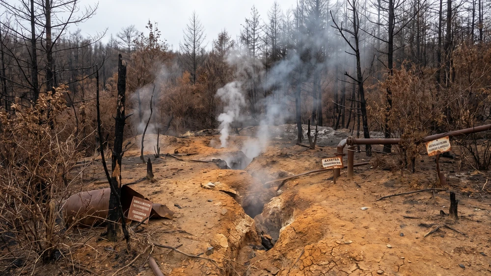
Beneath the quiet surface, a massive chemical reaction continues to consume the anthracite coal. The fire burns roughly 100 feet down and spreads across approximately 400 acres of underground tunnels. Temperatures near the active vents regularly exceed 176°F (80°C). Geologists estimate that the massive coal seams hold enough fuel to keep the fire burning for at least another 200 to 250 years.
The Population Collapse and the Remaining Residents
The numbers reveal the scale of the displacement. A thriving community of over 1,000 residents in 1981 collapsed into a ghost town of under 10 by the 2020 census. Following a massive federal relocation program, the state invoked eminent domain in 1992, condemning all buildings and taking ownership of the land.
Understanding Life-Estate Agreements
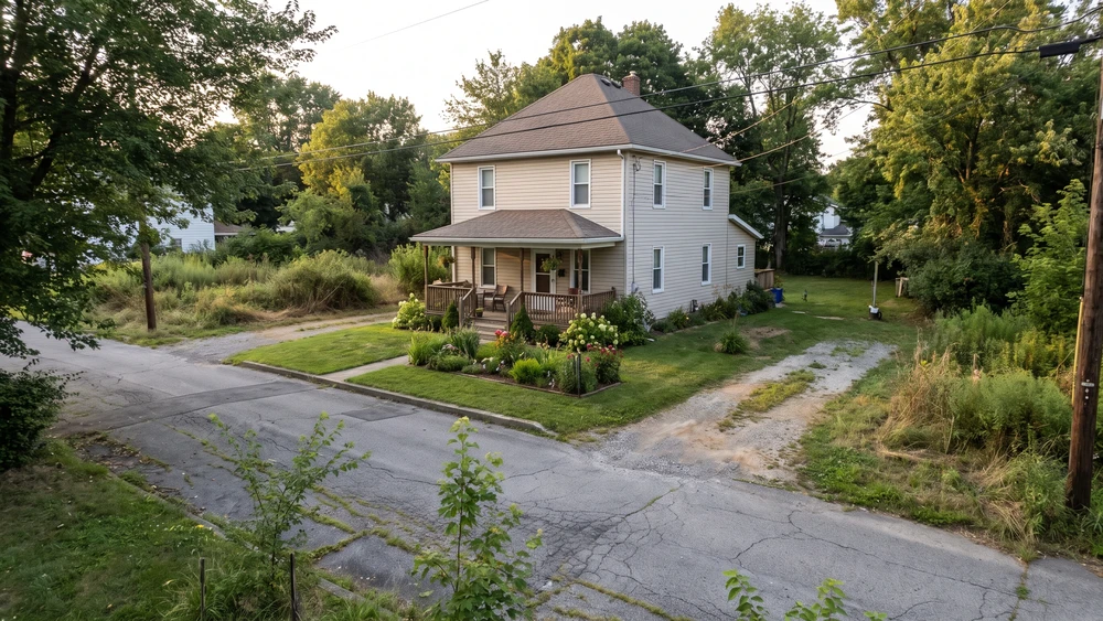
You will notice a handful of well-kept homes among the empty lots. These belong to the few remaining holdouts.
After decades of legal battles against eviction, the surviving residents reached a settlement with the state in 2013. They were granted life-estate agreements, meaning they received a cash payout and the right to live in their homes until they pass away. After that, the properties revert to the state and will be demolished.
When driving through the area, respect their privacy and never treat their private yards as a tourist attraction.
What Remains to Be Seen in Centralia Today
Pop culture has set the wrong expectations. There is no thick, cinematic fog raining ash from the sky like in Silent Hill. On a warm day, you might not even see smoke.
The Empty Grid: Overgrown Lots and Stray Fire Hydrants
The true visual impact of Centralia is what is missing: a stark, eerie absence. Empty streets end at nothing, and retaining walls hold up vanished foundations. Sidewalks are swallowed entirely by weeds and forest undergrowth.
If you walk the old residential grid along Locust Avenue or Troutwine Street, you will spot fire hydrants standing guard in the middle of the woods, completely detached from the civilization they were meant to protect. One functioning exception breaks that pattern: Centralia Fire Company No. 1, a volunteer department still staffed on Locust Avenue, continues responding to calls in the borough despite its near-total depopulation.
Assumption of the Blessed Virgin Mary Church
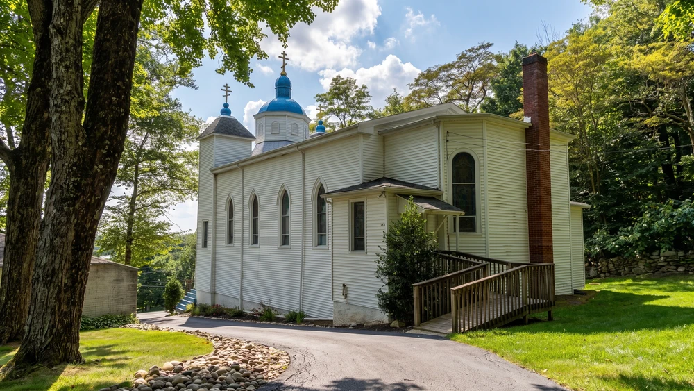
Sitting gracefully on a hill north of the borough, this striking blue-domed church survived the destruction. Because it was built on solid rock outside the burn zone, the underground fire never threatened its foundation. Our Lady of Sorrows Cemetery sits immediately adjacent to the church grounds, marking the burial site for generations of the original parish community.
The Ukrainian Greek-Catholic Church remains fully active. In 2015, Major Archbishop Sviatoslav Shevchuk designated it an official pilgrimage site. It stands as the last functioning piece of Centralia's original community. Signage marks the property line at the base of the entrance stairs, and the grounds are reserved for parishioners, so visitors view the church and cemetery from the public roadway rather than walking the grounds.
The Truth About the Graffiti Highway
For years, an abandoned stretch of Route 61, buckled by the heat and covered in layers of spray paint, was the main draw for urban explorers. That era is completely over.
Why the Highway Was Buried in 2020
During the early months of the 2020 pandemic, massive crowds flocked to the Graffiti Highway, bringing widespread vandalism, litter, and illegal ATV riding. The private owner of the land, Pagnotti Enterprises, decided to eliminate the liability.
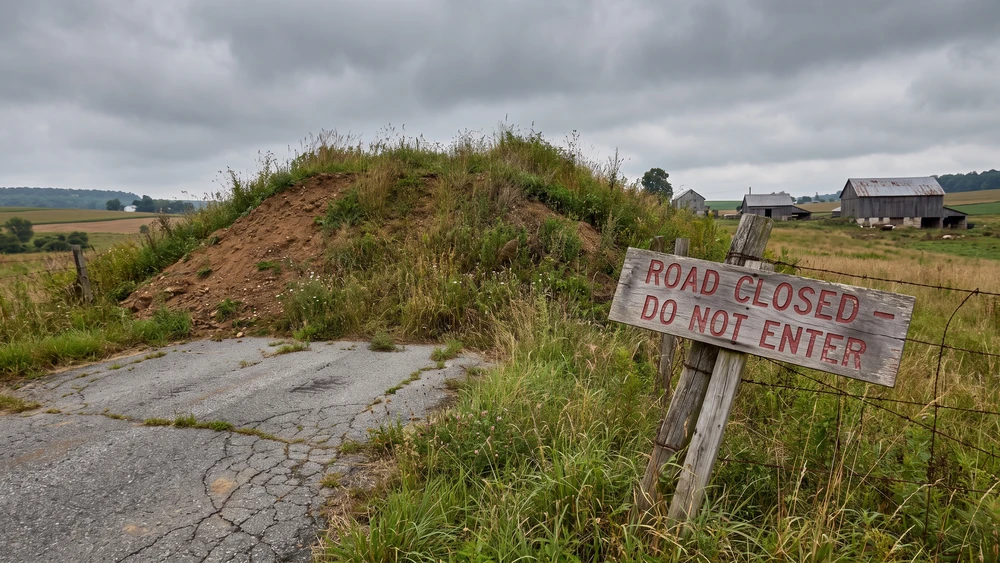
In April 2020, over 400 truckloads of dirt were hauled in, completely burying the asphalt under several feet of soil. Today, new vegetation is growing over the dirt mounds. The highway is gone, and local state police actively issue citations for trespassing in the area.
Is It Safe to Visit Centralia?
Visiting a site built over a burning mine comes with inherent, unmanaged risks. The danger here is not an exaggeration for television; it is geological reality. Centralia is not the only unusual American destination where the rules matter more than the sightseeing; similar caution applies if you are weighing a stop at Slab City's off-grid desert community further west.
The Pennsylvania DEP "Stay Out, Stay Alive" Warning
The Pennsylvania Department of Environmental Protection (DEP) maintains a strict "Stay Out, Stay Alive" policy regarding abandoned mine lands. While driving on the remaining public municipal roads is legal, venturing into the woods, walking near steam vents, or bypassing earthen berms puts you in direct conflict with state warnings and trespassing laws.
Toxic Gases and Ground Subsidence Risks
The two primary threats are invisible.
Carbon monoxide: Lethal gases vent unpredictably from the soil. In low-wind areas or depressions in the ground, these gases accumulate rapidly.
Ground subsidence: The fire burns away the coal pillars supporting the earth, creating massive underground voids. The ground above can, and has, collapsed suddenly without warning, creating deep, super-heated sinkholes.
How to Get to Centralia, PA
If you decide to observe the area, rely on main roads. Centralia sits near the intersection of PA Route 61 and PA Route 42 in Columbia County.
From Interstate 81, take the exit for Route 61 North near Frackville, then follow Route 61 North through Ashland. As you approach the borough limits, the bypass road curves around the old, closed section of Route 61.
Stay in your vehicle, stick to the maintained asphalt, and view the remnants of the grid from the safety of the public right-of-way. If Centralia is one stop on a longer loop through coal country, brushing up on general road trip planning and safety before you go is worth the extra few minutes.