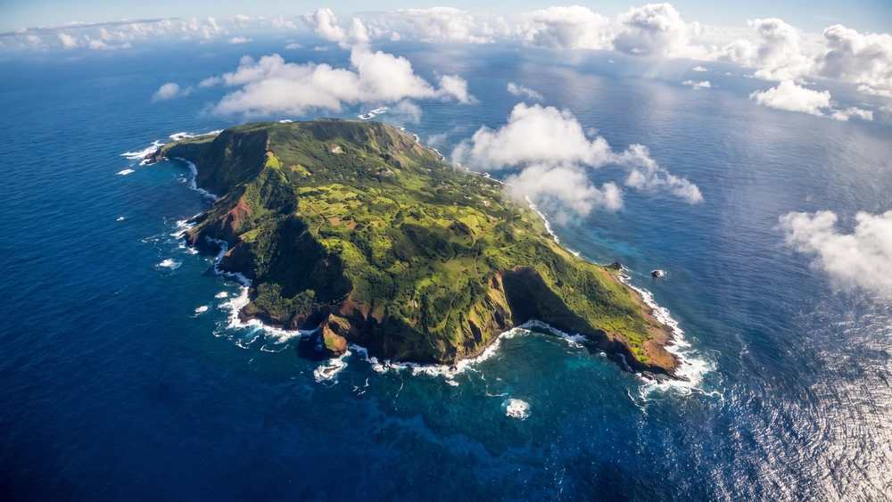
Navigating Pitcairn's volcanic terrain requires more than just a good pair of boots; the island's notorious red mud turns trails into severe slip-and-slides after even a brief tropical shower. Understanding which paths to tackle dry and which require a local guide is the exact difference between a rewarding hike and a dangerous misstep.
- Best time for hiking: June to August (cooler temperatures) and July to October (humpback whale season).
- Terrain: Steep volcanic rock, unpaved dirt trails, and highly slippery red clay.
- Must-have gear: Sturdy trail boots, a lightweight rain shell, and reef shoes for coastal pools.
- Guided access only: Down Rope Beach, due to a hazardous 700-foot cliff descent.
Before setting out, make sure the logistics are locked in first: our complete guide to visiting Pitcairn Island covers ship schedules, permits, and where to stay once you arrive.
The Bounty Legacy: Historic Sites in Adamstown
The Pitcairn Islands Museum and Mutineer Artifacts
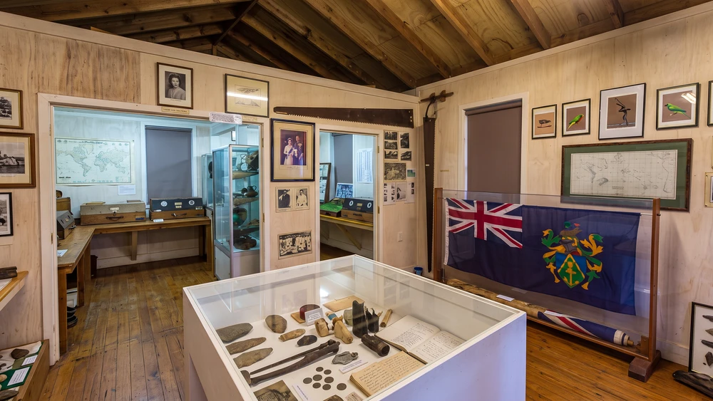
The museum sits just up a short flight of stairs behind the main public square. Inside, the original Bounty Bible and assorted ancient Polynesian stone tools share the display cases. Space is exceptionally tight. Arriving early when cruise ships are anchored offshore prevents you from waiting in long lines outside the entrance.
John Adams' Grave and the Giant Banyan Tree
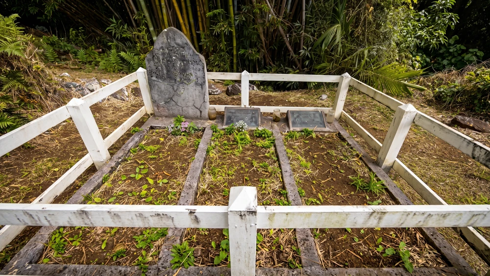
A short walk toward the outskirts of Adamstown leads to the only marked burial site of a Bounty mutineer. John Adams rests here beside his wife and daughter. Just before the cemetery turnoff, a massive, ancient banyan tree dominates the path.
The canopy is dense. Shadows stretch across the dirt road, offering a much-needed cool break from the midday sun.
The Bounty Anchor in the Town Square
Salvaged from the bay in 1957, the massive HMS Bounty anchor anchors the community square. This area serves as the island's central hub for both governance and socializing. Local artisans occasionally set up small tables nearby to sell traditional wood carvings, stamp covers, and pure island honey.
Tracing the Mutineers: Trails Around Bounty Bay
Bounty Bay Landing and the Shipwreck Site
The concrete landing at Bounty Bay faces relentless ocean surges daily. The actual wreckage of the HMS Bounty lies just a few meters beneath the waves, though time and tide have eroded most visible structural remains. Green sea turtles frequently navigate the shallow, churning waters near the breakwater.
Ascending the Hill of Difficulty
This 70-meter steep incline follows the exact route the mutineers took when they first scrambled ashore. The road is paved with concrete today, but the gradient remains brutal. Walking up this stretch under the afternoon sun drains energy rapidly. Take the ascent slow, lean forward, and stay heavily hydrated.
The Edge Lookout and Memorial Plaques
Positioned immediately on your left at the top of the Hill of Difficulty, The Edge provides an unobstructed, vertical view back down into Bounty Bay. It is an ideal spot to catch your breath after the steep climb. Commemorative plaques are mounted here to honor both the British mutineers and the Polynesian men and women who originally settled the island.
High-Elevation Hikes and Viewpoints
The Eco Trail to Fletcher Christian's Cave
The Eco Trail cuts through thick, overhanging rock formations and showcases Pitcairn's endemic flora. The path is relatively gentle and well-maintained until the final approach to the cave. Fletcher Christian allegedly used this cavern to anxiously watch the horizon for British search vessels. The final climb requires scrambling on all fours; avoid this section entirely if the rock faces are damp. Go with a local guide if you can; the entrance to the cave itself is easy to miss, and having someone who knows the route saves a lot of backtracking.
Highest Point (Pawala Valley Ridge) for 360-Degree Views
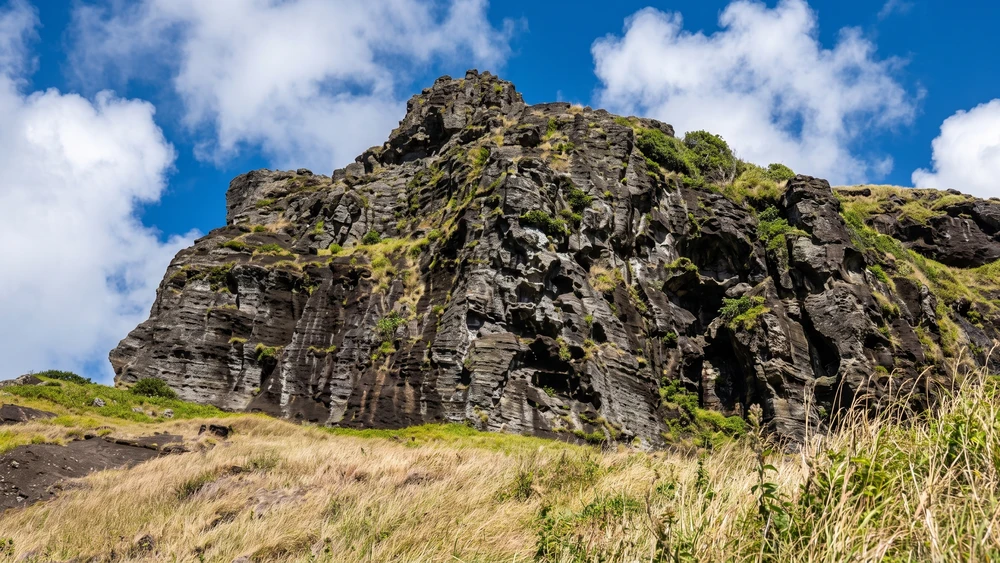
Reaching 347 meters above sea level, the island's Highest Point offers a panoramic sweep of the entire isolated archipelago. A quirky wooden signpost at the summit points out distances to various global cities. The trail up is completely exposed to the elements. Wind gusts at the top are strong enough to knock off an unsecured hat. Bring more water than you think you need; the road up is long and steep, and there is little shade along the way. A small hut with a barbecue area sits near the top, and the spot is a favorite for watching the sunset.
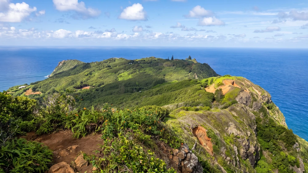
Ship's Landing Point
Located high above Bounty Bay, this strategic lookout is fitted with sturdy picnic tables and offers sweeping views directly over Adamstown. It serves as an excellent vantage point for landscape photography. The lighting is spectacular here during the golden hour, right when the fading sun hits the sharp volcanic ridges.
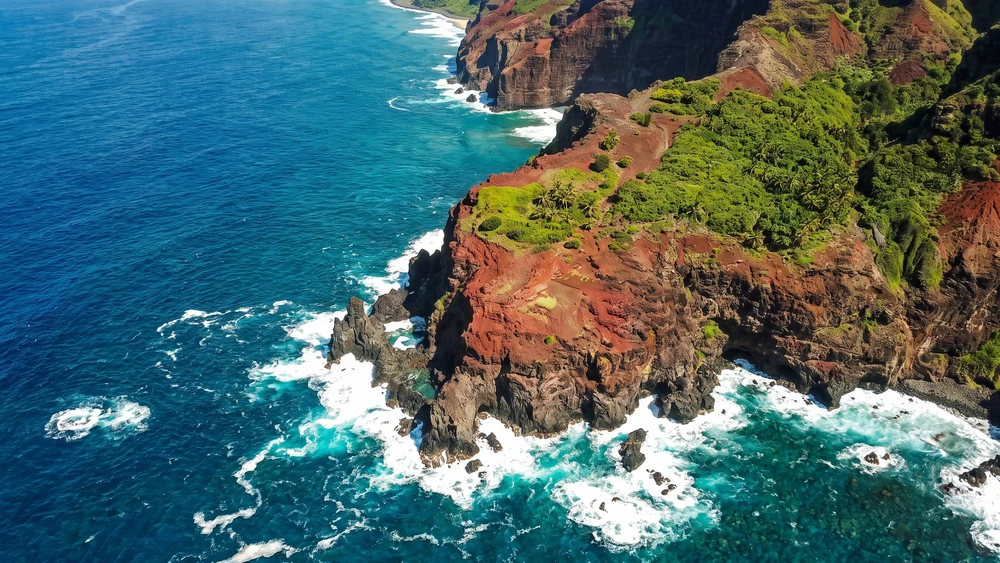
Coastal Treks: Natural Pools and Ancient Petroglyphs
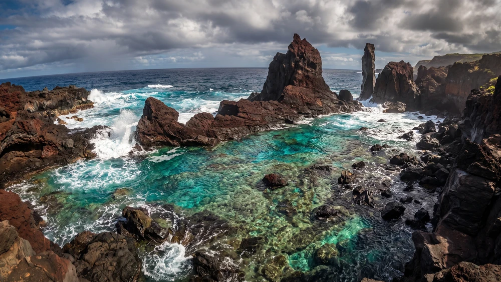
Swimming at St. Paul's Pool (Tide & Safety Tips)
St. Paul's is a tidal pool enclosed by a cathedral-like barrier of volcanic rocks, filled with crystal-clear ocean water. The dirt road leading down erodes easily and transitions into a steep series of jagged boulders. Reef shoes are mandatory here to prevent severe cuts on the volcanic glass.
Always check the tide schedule; rogue ocean waves frequently batter the outer rocks at high tide, making swimming extremely hazardous. On calmer days the pool is genuinely swimmable, and some visitors bring a mask and snorkel to look for fish and lobster hiding among the rocks.
The Steep Descent to Down Rope Beach
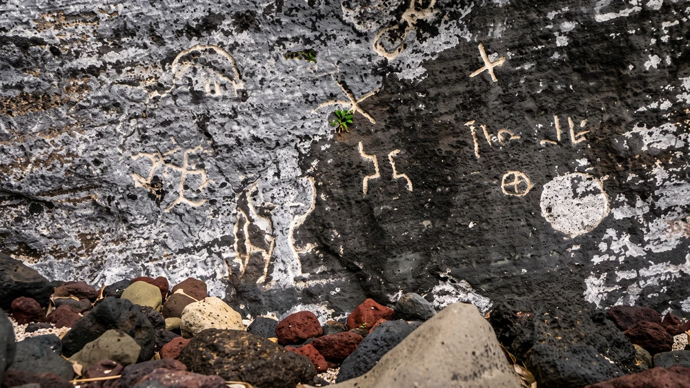
Pitcairn's only sandy beach sits isolated at the base of a sheer 700-foot cliff face. Ancient Polynesian petroglyphs are carved directly into the rock base at the bottom. Navigating the descent involves physically clinging to a rope through thick, unstable vegetation. Independent hiking here is strictly prohibited due to the severe fall risk; you must hire a local guide to attempt this route.
Seasonal Highlight: Humpback Whale Watching (July-October)
Humpback whales utilize the warm, protected waters surrounding the Pitcairn Islands for calving and breeding from mid-summer through early autumn. Ridge Rope Lookout provides the highest and clearest vantage point for spotting breaching adults. Binoculars are essential for tracking them from the higher trails, though massive pods occasionally surface right at the mouth of Bounty Bay, visible to the naked eye.