The Natchez Trace travel corridor holds over 10,000 years of history. Driving the entire route takes at least 10 hours without stops. Rushing through this landscape is a huge mistake. The real magic happens when you step out of your vehicle and explore the sunken trails deeply hidden in the woods.
What is the Difference Between the Parkway and the Trail?
The Natchez Trace Parkway is a 444-mile paved scenic motor road stretching from Natchez, Mississippi to Nashville, Tennessee. It is a smooth, highly regulated drive.
The Natchez Trace National Scenic Trail is completely different. It consists of five distinct hiking sections running roughly parallel to the paved road. These rugged foot trails total more than 60 miles and take you straight into the heart of the swamps and hardwood forests.
Key Mileposts and Historical Sites You Must See
The parkway is strictly organized by mileposts. You start at Milepost 0 in Natchez and finish at Milepost 444 near Nashville. Tracking your progress through these markers makes navigation incredibly simple.
[imgsrc="uploads/2026/03/natchez-trace-parkway-scenic-road-forest.webp"alt="AlongstretchoftheNatchezTraceParkwaywindingthroughadensegreenhardwoodforestundersoftdaylight."cp="The444-milejourneyoffersaseamlessblendofsmoothpavementandancientnature."]
Emerald Mound and Mount Locust (Milepost 10 to 15)
Emerald Mound is the second-largest ceremonial mound in the United States. The scale of this ancient earthwork is massive. Just a few miles north, you reach Mount Locust. This is one of the last remaining historic stands where early travelers rested centuries ago.
The Potkopinu Sunken Trail Section
The Potkopinu section offers the most authentic look at the original path. The trail here is literally a deeply eroded canyon. Centuries of heavy foot traffic from American Indians, soldiers, and settlers wore down the earth, creating natural dirt walls that tower 20 to 30 feet high.
[imgsrc="uploads/2026/03/potkopinu-sunken-trace-trail-canyon.webp"alt="DeeplyerodedearthenwallsofthePotkopinusunkentrailsectionoftheNatchezTraceforminganaturalcanyon."cp="Walkinthefootstepsofhistorywithinthe30-footdeepsunkenwallsofthePotkopinusection."]
Finding the entrance requires sharp eyes. The trailheads are notoriously hidden and often missing from standard maps. Look for the Daughters of the American Revolution boulder to easily locate the western entrance.
You will encounter two stream crossings along the path. Waterproof boots are absolutely essential here. The trail is beautifully secluded and perfect for dog walking, but it demands serious preparation in late summer.
The vegetation becomes aggressively overgrown from August through October. Micro ticks, huge spiders, and snakes are extremely common during this period. Bring heavy-duty bug spray, always wear long pants, and keep in mind that this section completely lacks restroom facilities.
The Meriwether Lewis Monument (Milepost 385.9)
Meriwether Lewis met a tragic end along the Old Trace in 1809. His burial site and monument sit peacefully in the Tennessee woods. The area is quiet, the surrounding forest is incredibly dense.
[imgsrc="uploads/2026/03/meriwether-lewis-monument-milepost.webp"alt="ThebrokencolumnstonemonumentofMeriwetherLewisatmilepost385.9ontheNatchezTraceParkway."cp="Thebrokencolumnmonumentstandsasatributetothetragicendofalegendaryexplorer."]
Essential Driving and RV Information
Navigating the parkway with a large rig requires strict adherence to National Park Service rules. Commercial vehicles are completely prohibited on this route.
- Maximum Length: Your vehicle setup, including any towed units, cannot exceed 55 feet.
- Bridge Clearances: Almost all bridges on the parkway have a minimum clearance of 14 feet. The only exceptions are the access roads to Jackson Falls and Magnum Mound.
- Speed Limit: The limit is strictly enforced at 50 mph for the entire 444-mile stretch.
- Entrance Fees: Access to the entire parkway and trail system costs exactly $0 (Free).
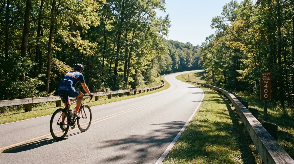
Cycling the Natchez Trace: 6-Day Itinerary Tips
The parkway is a designated bicycle route. The limited access points and total ban on commercial traffic make it a cyclist's paradise.
A standard end-to-end bicycle journey usually takes around 6 days. The elevation is generally easy, but the terrain can feel rugged on the legs over long distances. Motorists are legally required to fully change lanes when passing bicycles, making the journey much safer than standard highways.
[imgsrc="uploads/2026/03/cycling-natchez-trace-parkway-tour.webp"alt="AbicycletravelercyclingalongthepeacefulandforestedNatchezTraceParkwayroad."cp="Withnocommercialtraffic,theParkwayremainsoneofthepremiercyclingroutesintheUnitedStates."]
Free Camping Sites and Regulations along the Route
Finding a place to sleep along the parkway is straightforward. All campgrounds operated by the National Park Service along the Trace are available strictly on a first-come, first-served basis.
- Cost: Pitching a tent or parking your RV here requires exactly $0 (Free).
- Stay Limits: You can stay for a maximum of 14 consecutive nights.
- Facilities: These are primitive sites. Do not expect water or electrical hookups for your RV. Prepare your supplies accordingly before entering the parkway.