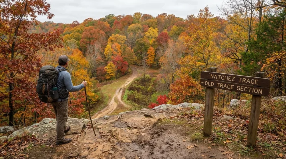
Many outdoor enthusiasts confuse the famous 444-mile driving route with the actual hiking experience. You are looking for the Natchez Trace National Scenic Trail, a distinct footpath system that runs alongside and sometimes intersects the paved Parkway.
While the scenic drive offers comfort, the 60-mile segmented trail invites you to walk in the footsteps of Native Americans, Kaintuck boatmen and soldiers from centuries past. This guide focuses entirely on the hiking experience, trail conditions and the specific gear you need for this historic terrain.
- Total Length: Approximately 60 miles (divided into 5 sections)
- Difficulty: Easy to Moderate
- Best Season: Spring and Late Autumn
- Trail Type: Point-to-point (Segmented)
- Entrance Fee: Free
- Camping Fee: Free (at designated Parkway campgrounds)
Natchez Trace Parkway vs. National Scenic Trail
Understanding the difference between the Parkway and the National Scenic Trail saves you from logistical headaches. The Parkway is a two-lane paved road managed by the National Park Service, perfect for a relaxed drive with a speed limit of 50 mph.
The National Scenic Trail, however, consists of five separate hiking sections distributed across Tennessee and Mississippi. You cannot hike the entire 444 miles on a protected trail; you must drive between these five specific hiking segments.
The 5 Official Hiking Sections
You will find that each section offers a drastically different environment, from waterfalls to swampy cypress forests. Choosing the right section depends on your fitness level and what you want to see.
Highland Rim Section (Tennessee)
This 20-mile stretch near Leiper’s Fork is arguably the most popular segment. It offers diverse scenery including hardwood forests and clear streams. The Garrison Creek loop within this section is a favorite for many, but you should be prepared for creek crossings.
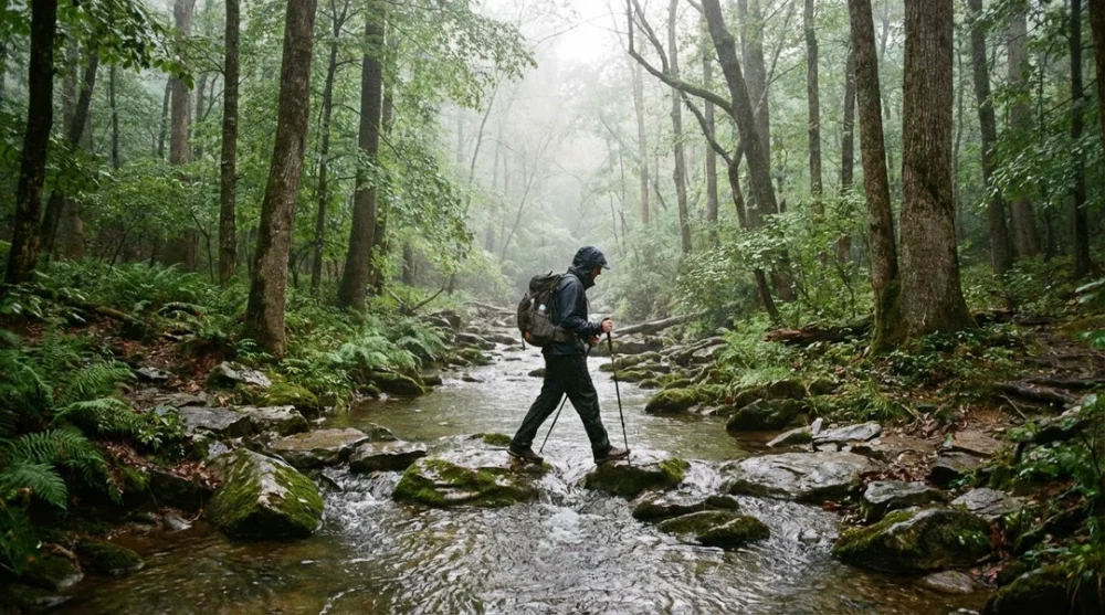
Heavy rains often swell the creeks, making the stepping stones submerged and slippery. If you plan to hike here after a storm, waterproof boots are essential to keep your feet dry during water crossings.
Blackland Prairie Section (Mississippi)
Located near Tupelo, this 6-mile section takes you through the urban interface and historic areas. It is relatively flat and accessible. History buffs appreciate this area for its proximity to the Chickasaw Village Site and the birthplace of Elvis Presley. The trail here often widens, making it suitable for walking side-by-side with a companion.
Yockanookany Section (Mississippi)
This is the longest continuous section, spanning about 26 miles near the Ross Barnett Reservoir. It is a nature lover's paradise but comes with a warning. Since it runs through low-lying wetland areas, the trail gets muddy and buggy faster than other sections.
You will walk through dense forests and cypress swamps. This area provides excellent opportunities for birdwatching, but you must bring strong insect repellent, especially in warmer months.
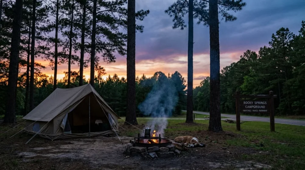
Rocky Springs Section (Mississippi)
For a shorter but atmospherically charged hike, the Rocky Springs segment offers about 6 miles of trail near Port Gibson. The terrain is gently rolling and less physically demanding than the Highland Rim. The highlight here is the ghost town of Rocky Springs. You can explore the remnants of a town abandoned due to yellow fever and soil erosion, adding a haunting historical layer to your outdoor activity.
Potkopinu Section (Mississippi)
If you only have time for one hike, choose Potkopinu. This 3-mile stretch creates a unique sunken effect. Centuries of foot traffic have worn the path so deep into the loess soil that the banks rise high above your head on either side.
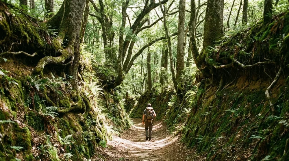
Walking here feels like traversing a green tunnel isolated from the modern world. It provides the most authentic feeling of what travelers experienced in the early 1800s.
Hiking Conditions & Seasonal Warnings
The Natchez Trace requires smart timing. Unlike high-altitude alpine trails, the challenge here is not thin air but the intense humidity and vegetation.
Summer Challenges: Hiking here in the peak of summer is generally not recommended. The heat index rises dangerously high and the vegetation becomes extremely dense. Hikers often report an overwhelming number of spider webs crossing the trail during summer months. You might find yourself waving a stick in front of your face for miles to clear webs, which ruins the serenity of the hike.
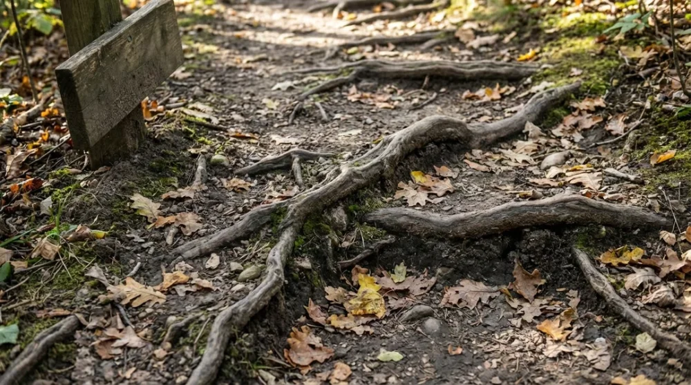
Maintenance Levels: You should expect a wilder experience than a manicured city park. Fallen trees and high grass are common occurrences, especially in the less-trafficked Yockanookany section. Trail maintenance crews work hard, but the rapid growth of vegetation in the South can overtake paths quickly. Wearing long pants is non-negotiable to protect yourself from poison ivy, ticks and scratchy underbrush.
Camping and Accommodation
You have excellent options for staying overnight without breaking the bank. The Natchez Trace Parkway manages three primitive campgrounds that are completely free.
- Meriwether Lewis Campground (Tennessee): Located near the northern terminus, this spot offers a quiet setting.
- Jeff Busby Campground (Mississippi): Situated at one of the highest points on the Trace, offering nice views.
- Rocky Springs Campground (Mississippi): Perfectly positioned for exploring the Rocky Springs and Potkopinu trail sections.
These campgrounds operate on a first-come, first-served basis. They do not offer electricity or hookups, but they provide restrooms and water. For those seeking more comfort, the towns of Natchez, Tupelo and Nashville offer a full range of hotels and B&Bs just a short drive from the trailheads.
Essential Gear List
The specific terrain of the Trace demands a focused gear list. Leave the heavy climbing gear at home and prioritize protection against moisture and insects.
- Tick and Mosquito Repellent: The humid environment thrives with insects. Treat your clothes with permethrin before you go.
- Waterproof Hiking Boots: Even if it hasn't rained recently, the morning dew on tall grass and muddy lowlands will soak sneakers instantly.
- Trekking Poles: These are helpful for stability on slippery mud and for clearing spider webs from your path.
- Navigation App: Cell service is spotty in the hollows. Download offline maps for the specific section you intend to hike.
How to Get There & Parking Tips
The Natchez Trace Parkway is accessible via multiple entrances, but finding the specific trailheads for the hiking sections requires attention. The Parkway uses a Milepost system for navigation.
- Highland Rim: Access near Milepost 427.
- Blackland Prairie: Access near Milepost 266 in Tupelo.
- Yockanookany: Access points range from Milepost 108 to 130.
- Rocky Springs: Look for the sign at Milepost 54.
- Potkopinu: The northern trailhead is near Milepost 20.
Parking is generally available at these mileposts. Do not leave valuables visible in your car, as remote trailheads can occasionally be targets for break-ins. Start your hike early in the morning to beat the heat and enjoy the solitude that this historic corridor offers.