Navigating Big Bend National Park often ends in sheer frustration because first-time visitors severely underestimate the massive driving distances and the absolute lack of cell service between trailheads. Arriving without a full tank of gas and a downloaded map is the fastest way to ruin your desert adventure. The environment is harsh, the roads are endlessly long, and the preparation required is significant.
The entrance fee is $30 per vehicle and covers all passengers for seven consecutive days. The park sits in one of the most remote corners of Texas, bordering Mexico along the Rio Grande, and it rewards visitors who come prepared.
Best Time to Visit Big Bend National Park
Summer in West Texas is dangerously hot. Temperatures regularly exceed 100 degrees Fahrenheit, making mid-day hiking a severe health risk. The ideal window for exploration is between November and April. During these cooler months, the daytime weather remains pleasant, the skies are brilliantly clear, and the trails are completely safe for longer treks.
Spring Break in March brings massive crowds. Campgrounds fill up months in advance, and parking at popular trailheads becomes a competitive sport. Visit in late fall or early winter for the perfect balance of manageable crowds and excellent hiking conditions.
How to Get to Big Bend National Park
Closest Airports: Midland vs. El Paso
You have to drive to reach this remote corner of Texas. Midland International Air and Space Port (MAF) sits about 3.5 hours away, making it the closest major flight hub. El Paso International Airport (ELP) is roughly 4.5 hours from the park entrance. El Paso generally offers cheaper flights and better rental car options. Renting an SUV or a high-clearance vehicle is a smart move if you plan to explore the dirt roads inside the park boundaries.
Essential Driving Tips
Gas stations are incredibly rare out here. You will find fuel at Panther Junction inside the park and outside the park in Terlingua. Always keep your tank above the half-way mark. Driving from one side of the park to the other can easily take over an hour and a half. Download your offline maps before leaving the airport. Once you pass Alpine or Marathon, your signal drops completely.
Understanding the Park: 3 Distinct Zones
The Chisos Mountains
The Chisos Mountains rise out of the flat desert like a massive sky island. The air is notably cooler, the pine trees thick and fragrant. This elevated zone provides a massive relief from the desert heat. Black bears and mountain lions actively roam these trails. You must carry your trash out and use the designated bear-proof storage boxes at campsites.
The Rio Grande River
The southern edge of the park follows the twists and turns of the Rio Grande. The water is surprisingly green, the limestone canyon walls impossibly steep. This zone serves as the natural border between the United States and Mexico. The ecosystem here is lush, contrasting heavily with the dry terrain just a few miles north.
The Chihuahuan Desert
Most of the park consists of the sprawling Chihuahuan Desert. The terrain is rugged, the cacti sharp and abundant. It looks barren at first glance, but a closer inspection reveals a landscape rich with ancient sea fossils and unique desert wildlife. Roadrunners and javelinas dominate this arid expanse. If you enjoy deepest canyons in the United States, the geological formations here will feel familiar.
Top Things to Do in Big Bend National Park
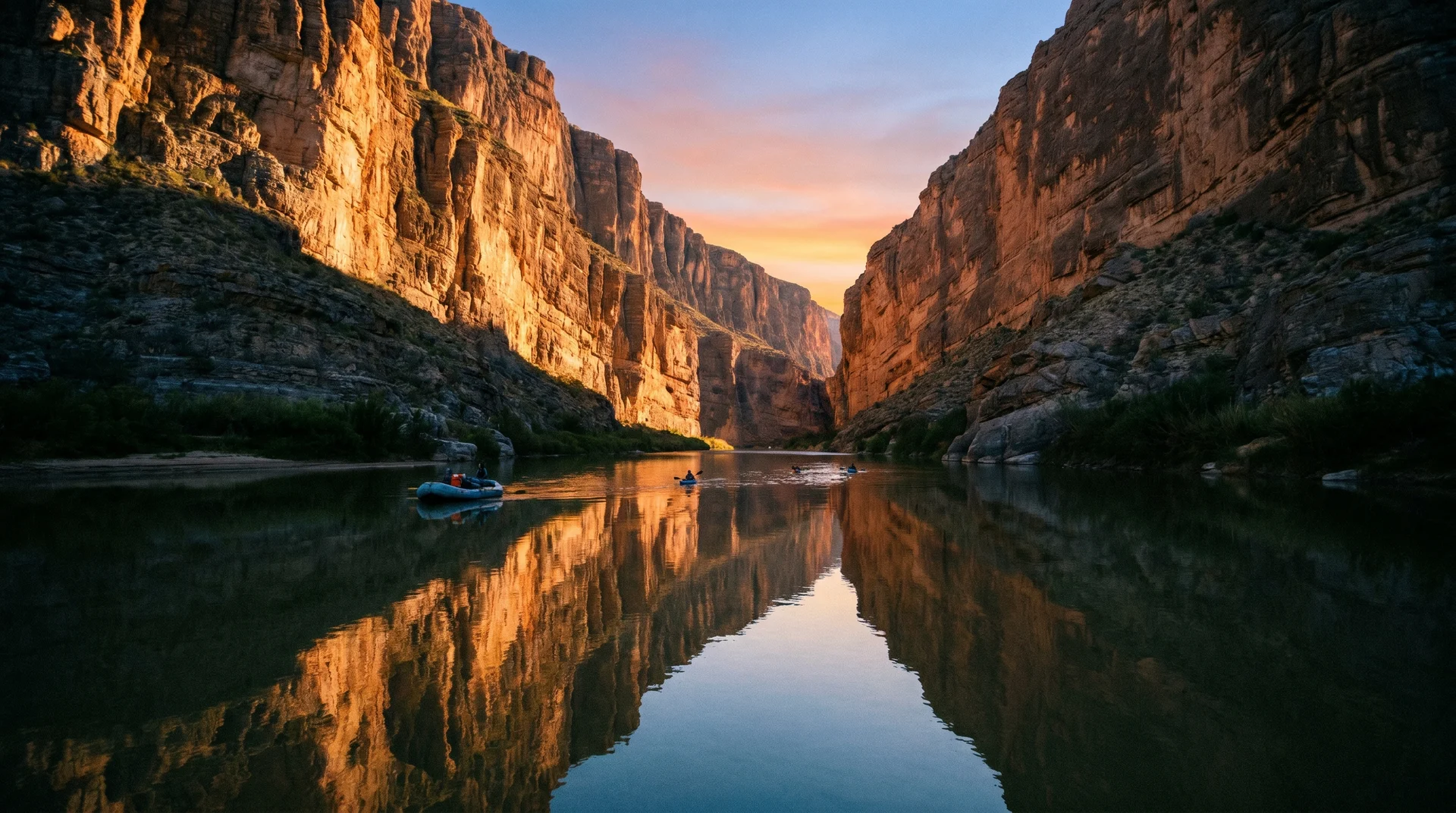
Hike the Santa Elena Canyon Trail
The Santa Elena Canyon Trail is a mandatory stop. The trail is a 1.7-mile round trip with a minor 80-foot elevation gain. You start by crossing the dry Terlingua Creek bed before climbing a short set of paved steps. The path then drops right down to the edge of the Rio Grande.
Arrive at sunrise. The morning light hits the 1,500-foot cliff walls perfectly, and you avoid the intense afternoon heat.
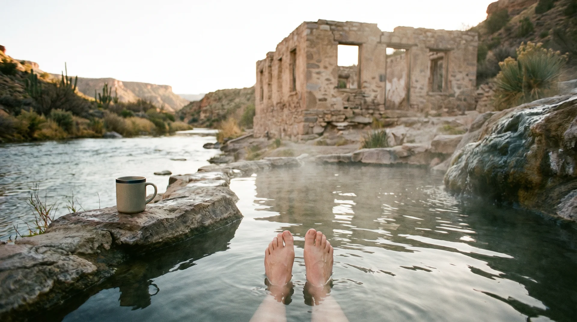
Soak in the Langford Hot Springs
A short dirt road on the east side of the park leads to the Hot Springs Historic District. The walk from the parking lot is extremely brief. The natural spring feeds into a foundation of an old bathhouse, creating a 105-degree natural tub right on the edge of the river. Bring water shoes to navigate the muddy riverbank comfortably.
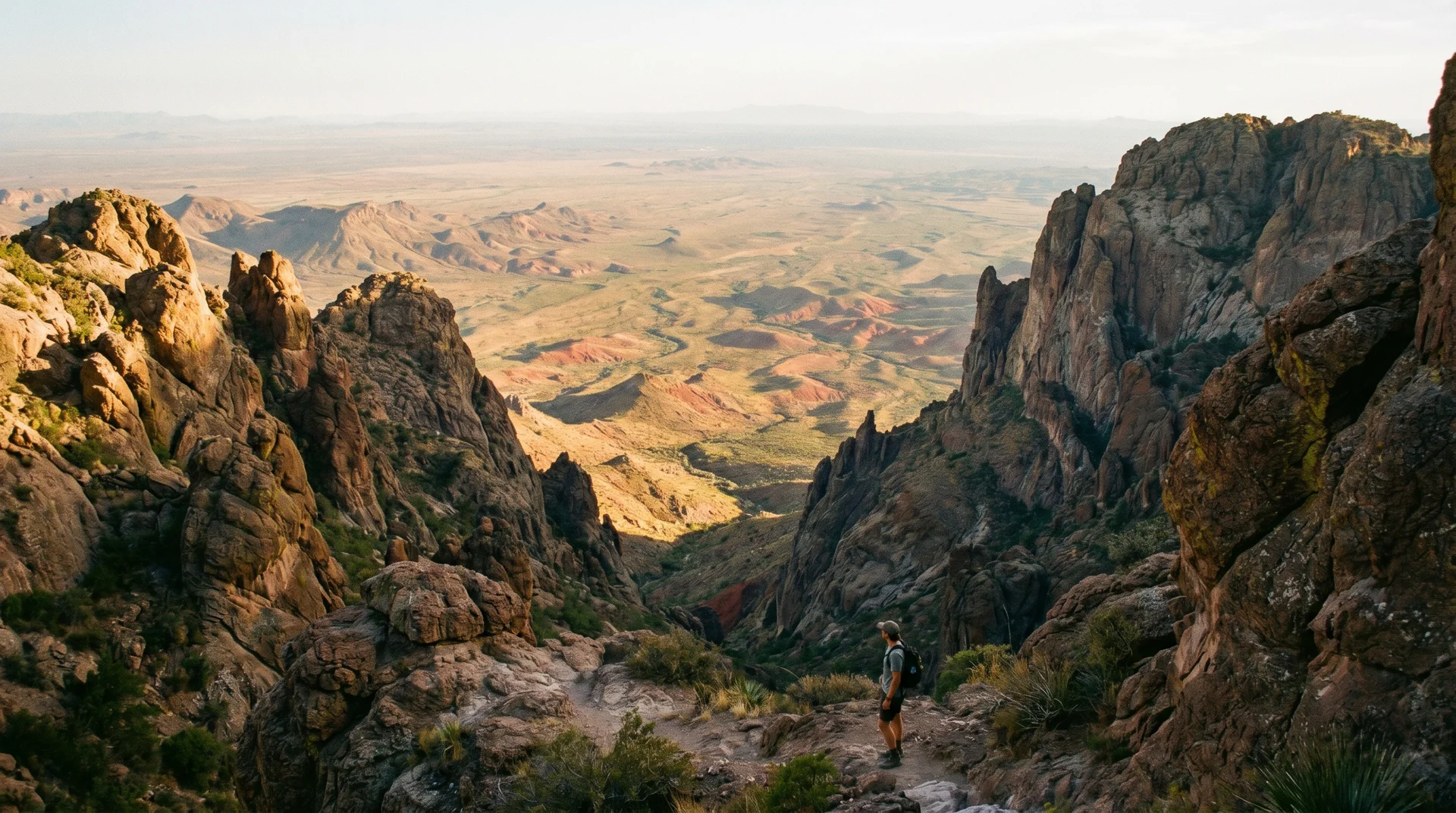
Conquer The Window Trail
The Window Trail is a 5.5-mile out and back hike starting from the Chisos Basin. It features a deceptive reverse elevation profile. You hike downhill on the way out, meaning the return trip is entirely uphill. The trail ends at a dramatic V-shaped notch in the mountains, framing a perfect view of the desert floor below. Start this hike before 8 AM to secure parking and beat the midday sun.
Drive the Ross Maxwell Scenic Drive
If hiking is not on your agenda, the Ross Maxwell Scenic Drive offers the best windshield views in Texas. This 30-mile paved route winds past historic ranch ruins and massive volcanic tuff formations. Stop at the Lower Burro Mesa Pouroff and the iconic Mule Ears Viewpoint. The drive terminates spectacularly at the entrance of Santa Elena Canyon.
Big Bend Camping and Lodging Options
Chisos Mountains Lodge
The Chisos Mountains Lodge is the only traditional hotel located within the park boundaries. Nestled at 5,400 feet, it offers basic rooms and stone cottages with incredible sunset views. Securing a room requires booking up to a year in advance due to extremely high demand.
Developed Campgrounds
The park operates three frontcountry campgrounds: Rio Grande Village, Chisos Basin, and Cottonwood.
- Rio Grande Village is the largest, offering the only full RV hookups and proximity to a camp store with showers.
- Chisos Basin puts you right at the start of the best mountain trails.
- Cottonwood is quieter, offering extensive shade near the river.
Permits cost $16 per night. All spots require advance reservations via recreation.gov.
Backcountry and High-Clearance 4x4 Camping
For total isolation, Big Bend offers incredible backcountry roadside campsites. Reaching spots along Old Ore Road or River Road absolutely requires a rugged 4x4 vehicle with sturdy all-terrain tires. Standard road tires will blow out on these sharp rocks. Backcountry permits cost $10 per night and must be picked up in person at a visitor center. If you enjoy remote road trip camping, the Natchez Trace Trail offers a very different but equally rewarding experience.
Crossing the Border: Visiting Boquillas del Carmen
Taking a day trip to the Mexican village of Boquillas del Carmen is a unique highlight. You must have a valid passport to cross at the Boquillas Crossing Port of Entry. A local ferry operator will row you across the shallow river for a $5 round-trip fee.
Once across, you can walk the short dirt path into town or pay for a burro ride. The village is incredibly welcoming. Eat authentic goat tacos, buy handmade wire scorpions, and enjoy a cold drink before heading back through US Customs. If exploring Mexico's border towns is on your list, reading about what $100 buys you in Mexico is worth your time before you cross.
Texas Road Trip Connections
Big Bend sits in the middle of some of Texas's most scenic terrain. If you are already making the long drive out to the Trans-Pecos region, combining your trip with a stop at the Marfa Lights viewing area adds almost nothing to your mileage. Marfa is roughly 90 minutes north of the park and makes for an excellent overnight stop. The high desert light and the art scene there are completely unlike anywhere else in the state.
For visitors who enjoy water-based activities after spending days in the dry desert, tubing on a Texas river is a natural next step. The Guadalupe and Comal rivers near New Braunfels are a full day's drive east but worth considering as a finale to your Big Bend itinerary.